Subject: Steeples Range
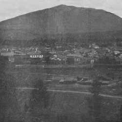
1910 Cranbrook Panaramic View
An early panaramic view of Cranbrook in 1910. This picture is taken from the west. looking east toward the Rocky Mountains.
| Internal ID: | 0003.0025 |
|---|---|
| Medium: | Photograph |
| Date: | 1910 |
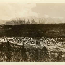
Panoramic View of Cranbrook, BC c.1936
Panoramic View of Cranbrook, BC looking east c.1936. Notice the Steeples in the background.
| Internal ID: | 0017.0075 |
|---|---|
| Medium: | Photograph |
| Date: | 1936 |
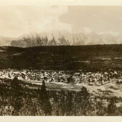
Panoramic View of Cranbrook, BC c.1936
Panoramic View of Cranbrook, BC looking east c.1936. Notice the Steeples in the background.
| Internal ID: | 0017.0076 |
|---|---|
| Medium: | Photograph |
| Date: | 1936 |
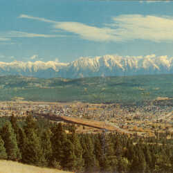
Panoramic View of Cranbrook, BC c.1950
Panoramic View of Cranbrook, BC looking east c.1950. Notice the Steeples in the background.
| Internal ID: | 0017.0077 |
|---|---|
| Medium: | Photograph |
| Date: | 1950 |
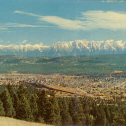
Panoramic View of Cranbrook, BC c.1950
Panoramic View of Cranbrook, BC looking east c.1950. Notice the Steeples in the background.
| Internal ID: | 0017.0078 |
|---|---|
| Medium: | Photograph |
| Date: | 1950 |
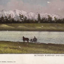
Scenic View of the Rockies
The Rocky Mountains between Wardner and Cranbrook, BC, known as The Steeples.
| Internal ID: | 0036.0015 |
|---|---|
| Medium: | Photograph |
| Date: | 1905 |
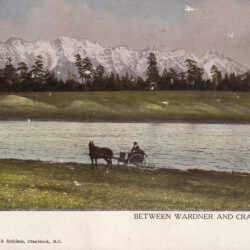
Scenic View of the Rockies
The Rocky Mountains between Wardner and Cranbrook, BC, known as The Steeples.
| Internal ID: | 0036.0016 |
|---|---|
| Medium: | Photograph |
| Date: | 1905 |
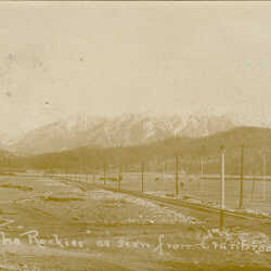
The "Rockies" as seen from Cranbrook, B.C.
Used sepia real photo postcard of The Steeples range of the Rocky Mountains from Cranbrook with railway tracks, telephone poles and prairie in the foreground. Addressed with Cranbrook circle date stamp on back.
| Internal ID: | 0039.0069 |
|---|---|
| Medium: | Postcard |
| Date: | 1905 |
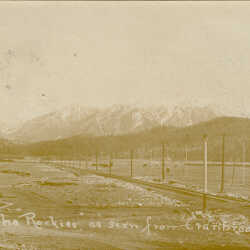
The "Rockies" as seen from Cranbrook, B.C.
Used sepia real photo postcard of The Steeples range of the Rocky Mountains from Cranbrook with railway tracks, telephone poles and prairie in the foreground. Addressed with Cranbrook circle date stamp on back.
| Internal ID: | 0039.0070 |
|---|---|
| Medium: | Postcard |
| Date: | 1905 |
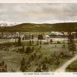
The Fisher Range, Cranbrook, BC with St. Eugene Hospital
Unused hand coloured real photo postcard long view of Cranbrook BC taken from West Hill (race track) facing East with Fisher Peak and the Steeples Range in background. St. Eugene Hospital in foreground. Central School visible in background. Made in England.
| Internal ID: | 0039.0115 |
|---|---|
| Medium: | Postcard |
| Date: | 1930 |
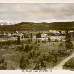
The Fisher Range, Cranbrook, BC with St. Eugene Hospital
Unused hand coloured real photo postcard long view of Cranbrook BC taken from West Hill (race track) facing East with Fisher Peak and the Steeples Range in background. St. Eugene Hospital in foreground. Central School visible in background. Made in England.
| Internal ID: | 0039.0116 |
|---|---|
| Medium: | Postcard |
| Date: | 1930 |
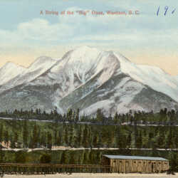
A String of the 'Big' Ones, Wardner, BC
Unused colour printed postcard of The Steeples Range near Wardner, BC with a horse barn or ckicken coop in foreground.
| Internal ID: | 0039.0213 |
|---|---|
| Medium: | Postcard |
| Date: | 1915 |
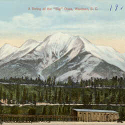
A String of the 'Big' Ones, Wardner, BC
Unused colour printed postcard of The Steeples Range near Wardner, BC with a horse barn or ckicken coop in foreground.
| Internal ID: | 0039.0214 |
|---|---|
| Medium: | Postcard |
| Date: | 1915 |
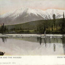
Wardner, B.C.
Kootenay River and the Rockies from Wardner, B.C.
| Internal ID: | 0039.0475 |
|---|---|
| Medium: | Photograph |
| Date: | March 7th 1909 |
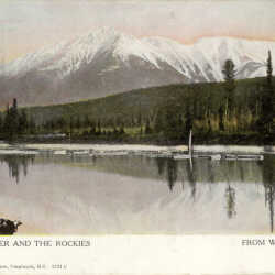
Wardner, B.C.
Kootenay River and the Rockies from Wardner, B.C.
| Internal ID: | 0039.0476 |
|---|---|
| Medium: | Photograph |
| Date: | March 7th 1909 |
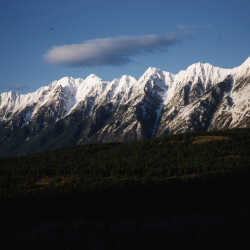
The Steeples Range
The Steeples Range outside Cranbrook, BC, May 1961.
| Internal ID: | 0047.0382 |
|---|---|
| Medium: | Photograph |
| Date: | May 1st 1961 |
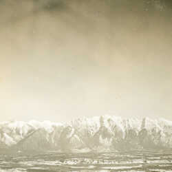
Lone Peak and Lakit Mountain and the Steeples Range
View of Rockies, Lone Peak and Lakit Mountain from 3000 ft. altitude, near Fort Steele, B.C., 1938.
| Internal ID: | 0138.0006 |
|---|---|
| Medium: | Photograph |
| Date: | 1938 |
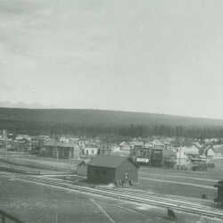
View of Cranbrook, BC looking Southeast c.1904
View of Cranbrook, BC c.1904 from top of C.P. Railway coaling tower. Notice Cranbrook Railway Station on the left hand side of the photo.
| Internal ID: | 0140.0005 |
|---|---|
| Medium: | Photograph |
| Date: | 1904 |
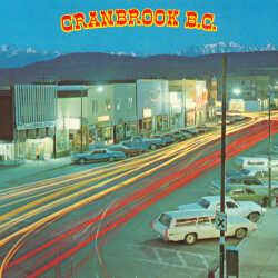
Baker Street at Night, Cranbrook, B.C.
A postcard view of Cranbrook, B.C. with The Steeples in distance, 1973. Photo by E. Anderson. Back of postcard Reads: "Surging traffic traces a pattern of light along busy Baker Street, Cranbrook's main arterial. Baker Street was named for Colonel Baker, an early surveyor and entrepreneur, who obtained Joseph's Prairie from the Indians. Cranbrook developed on the site after the arrival of the railroad. Today this vigorous, booming city has a population close to 16,000 and is the largest in southeastern British Columbia. Snowy Mt. Fisher (2846 meters - 9336 ft.) and the Steeples rim the horizon."
| Internal ID: | 0283.0003 |
|---|---|
| Medium: | Postcard |
| Date: | 1973 |
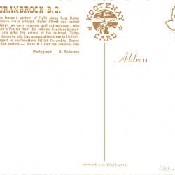
Baker Street at Night, Cranbrook, B.C.
A postcard view of Cranbrook, B.C. with The Steeples in distance, 1973. Photo by E. Anderson. Back of postcard Reads: "Surging traffic traces a pattern of light along busy Baker Street, Cranbrook's main arterial. Baker Street was named for Colonel Baker, an early surveyor and entrepreneur, who obtained Joseph's Prairie from the Indians. Cranbrook developed on the site after the arrival of the railroad. Today this vigorous, booming city has a population close to 16,000 and is the largest in southeastern British Columbia. Snowy Mt. Fisher (2846 meters - 9336 ft.) and the Steeples rim the horizon."
| Internal ID: | 0283.0004 |
|---|---|
| Medium: | Postcard |
| Date: | 1973 |
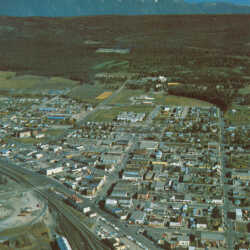
Overview of Cranbrook, B.C.
An overview of Cranbrook, B.C. with The Steeples in distance, 1973. Photo by E. Anderson. Back of postcard reads: "Originally known as Joseph's Prairie, Cranbrook sprang into prominence with the arrival of the railroad in the late 1890's. Today it has become the major transportation hub of southeastern B.C. and serves as a gateway to the Canadian Rockies. With a population well over 12,000, booming Cranbrook is also the economic and adminitrative nerve center of the East Kootenay. Baker Street appears in the middle with the new Cranbrook Mall and hospital beyond. The snowy Steeples rise in the distance."
| Internal ID: | 0283.0005 |
|---|---|
| Medium: | Postcard |
| Date: | 1975 |
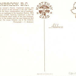
Overview of Cranbrook, B.C.
An overview of Cranbrook, B.C. with The Steeples in distance, 1973. Photo by E. Anderson. Back of postcard reads: "Originally known as Joseph's Prairie, Cranbrook sprang into prominence with the arrival of the railroad in the late 1890's. Today it has become the major transportation hub of southeastern B.C. and serves as a gateway to the Canadian Rockies. With a population well over 12,000, booming Cranbrook is also the economic and adminitrative nerve center of the East Kootenay. Baker Street appears in the middle with the new Cranbrook Mall and hospital beyond. The snowy Steeples rise in the distance."
| Internal ID: | 0283.0006 |
|---|---|
| Medium: | Postcard |
| Date: | 1975 |
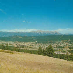
Overview of Cranbrook, B.C.
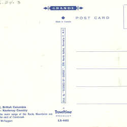
An overview of Cranbrook, B.C. with The Steeples in background, ca. 1975. Photo by Derse McTaggart. Back of card reads: "The peaks of the main range of the Rocky Mountains are seen rising to the east of Cranbrook."
| Internal ID: | 0283.0007 |
|---|---|
| Medium: | Postcard |
| Date: | 1975 |
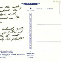
Overview of Cranbrook, B.C.
An overview of Cranbrook, B.C. with The Steeples in background, ca. 1975. Photo by Derse McTaggart. Back of card reads: "The peaks of the main range of the Rocky Mountains are seen rising to the east of Cranbrook."
| Internal ID: | 0283.0008 |
|---|---|
| Medium: | Postcard |
| Date: | 1975 |
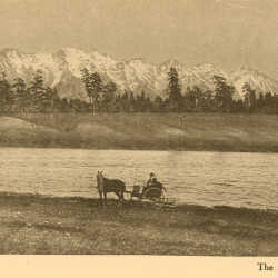
The Steeples Range
ALBUM Cranbrook, B.C.-Titled 'The Rockies from Cranbrook' but more properly the Steeples Range from Wardner with the Kootenay River visible. LINK WITH 0366.0013
| Internal ID: | 0366.0026 |
|---|---|
| Medium: | Photograph |
| Date: | 1910 |
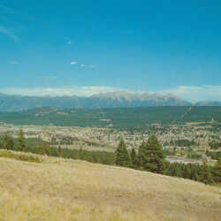
Overview of Cranbrook and The Steeple Range
A postcard photo by Dorse McTaggart showing the city of Cranbrook in the early 1970s with The Steeples range in the background.
| Internal ID: | 0402.0005 |
|---|---|
| Medium: | Postcard |
| Date: | 1970 |
Overview of Cranbrook and The Steeple Range
A postcard photo by Dorse McTaggart showing the city of Cranbrook in the early 1970s with The Steeples range in the background.
| Internal ID: | 0402.0006 |
|---|---|
| Medium: | Postcard |
| Date: | 1970 |
Aerial View of Baker Street, Cranbrook
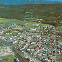
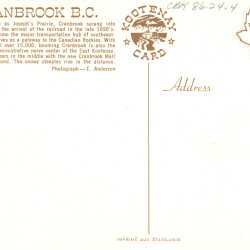
A postcard photo by E. Anderson showing an aerial view of Cranbrook. Back reads: "Originally known as Joseph's Prairie, Cranbrook sprang into prominence with the arrival of the railroad in the late 1890's. Today it has become the major transportation hub of southeastern B.C., and serves as a gateway to the Canadian Rockies. With a population well over 15,000, booming Cranbrook is also the economic and administrative nerve center of the East Kootenay. Baker Street appears in the middle with the new Cranbrook Mall and hospital beyond. The snowy Steeples rise in the distance."
| Internal ID: | 0402.0007 |
|---|---|
| Medium: | Photograph |
| Date: | 1970 |
Aerial View of Baker Street, Cranbrook
A postcard photo by E. Anderson showing an aerial view of Cranbrook. Back reads: "Originally known as Joseph's Prairie, Cranbrook sprang into prominence with the arrival of the railroad in the late 1890's. Today it has become the major transportation hub of southeastern B.C., and serves as a gateway to the Canadian Rockies. With a population well over 15,000, booming Cranbrook is also the economic and administrative nerve center of the East Kootenay. Baker Street appears in the middle with the new Cranbrook Mall and hospital beyond. The snowy Steeples rise in the distance."
| Internal ID: | 0402.0008 |
|---|---|
| Medium: | Photograph |
| Date: | 1970 |
Overview of Cranbrook, B.C.
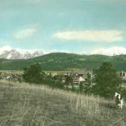
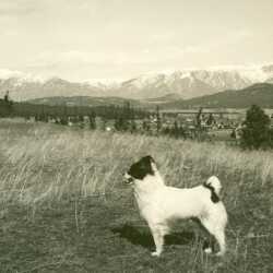
Cranbrook, B.C. Overlooking the city with a dog in foreground and Fisher Peak and The Steeples (Hughes Range) in the background.
| Internal ID: | 0451.0003 |
|---|---|
| Medium: | Photograph |
| Date: | 0000 |
Overview of Cranbrook, B.C.
Cranbrook, B.C. Overlooking the city with a dog in foreground and Fisher Peak and The Steeples (Hughes Range) in the background.
| Internal ID: | 0451.0004 |
|---|---|
| Medium: | Photograph |
| Date: | 0000 |
Overview of Cranbrook and the Steeples Range
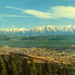
An overview of Cranbrook taken from the west showing the CPR rail yards with the city sprawling behind. In the distance is the imposing Steeples Range of the Canadian Rockies.
| Internal ID: | 0460.0012 |
|---|---|
| Medium: | Photograph |
| Date: | 1965 |
Overview of Cranbrook and the Steeples Range
An overview of Cranbrook taken from the west showing the CPR rail yards with the city sprawling behind. In the distance is the imposing Steeples Range of the Canadian Rockies.
| Internal ID: | 0460.0013 |
|---|---|
| Medium: | Photograph |
| Date: | 1965 |
The Steeples Range
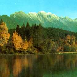
A small lake in the foreground (possibly Garbutts Lake) is showcased by the Steeples Range with its first dusting of fall snow.
| Internal ID: | 0460.0014 |
|---|---|
| Medium: | Photograph |
| Date: | 1965 |
The Steeples Range
A small lake in the foreground (possibly Garbutts Lake) is showcased by the Steeples Range with its first dusting of fall snow.
| Internal ID: | 0460.0015 |
|---|---|
| Medium: | Photograph |
| Date: | 1965 |
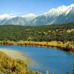
Kootenay River and The Steeples
An autumn view of the Kootenay River framed by the snow-capped Steeples Range, before the construction of the Libby Dam.
| Internal ID: | 0460.0016 |
|---|---|
| Medium: | Photograph |
| Date: | 1965 |
Kootenay River and The Steeples
An autumn view of the Kootenay River framed by the snow-capped Steeples Range, before the construction of the Libby Dam.
| Internal ID: | 0460.0017 |
|---|---|
| Medium: | Photograph |
| Date: | 1965 |
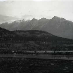
View from Train, Crowsnest Line
A view of the Kootenay River and the Steeples from a train, Crowsnest Line, Sept 12th 1912, negative pocket #65.
| Internal ID: | 0518.0001 |
|---|---|
| Medium: | Photograph |
| Date: | September 12th 1912 |