Subject: Sports
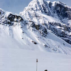
Kluane National Park, Yukon c.1958
Overlooking one of the peaks in the Kluane National Park, Yukon c.1958
| Internal ID: | 0047.0233 |
|---|---|
| Medium: | Photograph |
| Date: | 1958 |
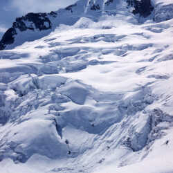
Kluane National Park, Yukon c.1958
A mountain in the Kluane National Park, Yukon c.1958
| Internal ID: | 0047.0234 |
|---|---|
| Medium: | Photograph |
| Date: | 1958 |
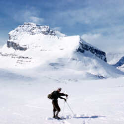
Kluane National Park, Yukon c.1958
A skier in the Kluane National Park, Yukon c.1958
| Internal ID: | 0047.0235 |
|---|---|
| Medium: | Photograph |
| Date: | 1958 |
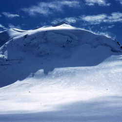
Kluane National Park, Yukon c.1958
A mountain in the Kluane National Park, Yukon c.1958
| Internal ID: | 0047.0237 |
|---|---|
| Medium: | Photograph |
| Date: | 1958 |
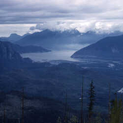
Kluane National Park, Yukon c.1958
The Kluane National Park, Yukon taken from a plane c.1958
| Internal ID: | 0047.0238 |
|---|---|
| Medium: | Photograph |
| Date: | 1958 |
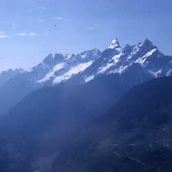
Kluane National Park, Yukon c.1958
The Kluane National Park, Yukon taken from a plane c.1958
| Internal ID: | 0047.0239 |
|---|---|
| Medium: | Photograph |
| Date: | 1958 |
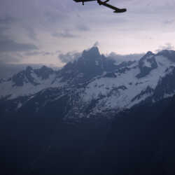
Kluane National Park, Yukon c.1958
The Kluane National Park, Yukon taken from a plane c.1958
| Internal ID: | 0047.0240 |
|---|---|
| Medium: | Photograph |
| Date: | 1958 |
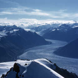
Kluane National Park, Yukon c.1958
A Glacier in the Kluane National Park in the Yukon c.1958 The Donjek Glacier or Kaskawulsh Glacier
| Internal ID: | 0047.0241 |
|---|---|
| Medium: | Photograph |
| Date: | 1958 |
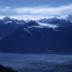
Kluane National Park, Yukon c.1958
A Glacier in the Kluane National Park in the Yukon c.1958 Possibly The Donjek Glacier or Kaskawulsh Glacier.
| Internal ID: | 0047.0243 |
|---|---|
| Medium: | Photograph |
| Date: | 1958 |
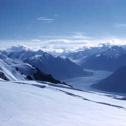
Kluane National Park, Yukon c.1958
A Glacier in the Kluane National Park in the Yukon c.1958 Possibly The Donjek Glacier or Kaskawulsh Glacier.
| Internal ID: | 0047.0244 |
|---|---|
| Medium: | Photograph |
| Date: | 1958 |
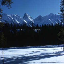
Kluane National Park, Yukon c.1958
The Kluane National Park, Yukon c.1958
| Internal ID: | 0047.0245 |
|---|---|
| Medium: | Photograph |
| Date: | 1958 |
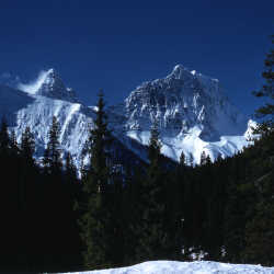
Kluane National Park, Yukon c.1958
The Kluane National Park, Yukon c.1958
| Internal ID: | 0047.0246 |
|---|---|
| Medium: | Photograph |
| Date: | 1958 |
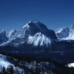
Kluane National Park, Yukon c.1958
The Kluane National Park, Yukon c.1958
| Internal ID: | 0047.0247 |
|---|---|
| Medium: | Photograph |
| Date: | 1958 |
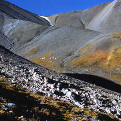
Kluane National Park, Yukon c.1958
Mountain Goats (dahl sheep?) in Kluane National Park, Yukon c.1958
| Internal ID: | 0047.0248 |
|---|---|
| Medium: | Photograph |
| Date: | 1958 |
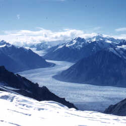
Kluane National Park, Yukon c.1958
A Glacier in the Kluane National Park in the Yukon c.1958 possibly The Donjek Glacier or Kaskawulsh Glacier
| Internal ID: | 0047.0249 |
|---|---|
| Medium: | Photograph |
| Date: | 1958 |
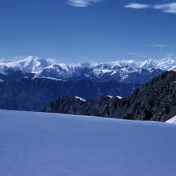
Kluane National Park, Yukon c.1958
The Kluane National Park, Yukon c.1958
| Internal ID: | 0047.0250 |
|---|---|
| Medium: | Photograph |
| Date: | 1958 |
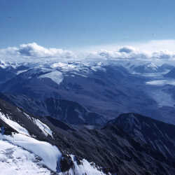
Kluane National Park, Yukon c.1958
A Glacier in the Kluane National Park in the Yukon c.1958 possibly The Donjek Glacier or Kaskawulsh Glacier
| Internal ID: | 0047.0251 |
|---|---|
| Medium: | Photograph |
| Date: | 1958 |
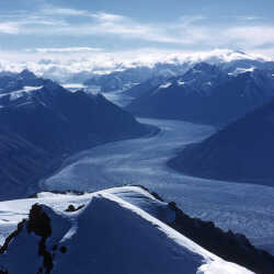
Kluane National Park, Yukon c.1958
A Glacier in the Kluane National Park in the Yukon c.1958 possibly The Donjek Glacier or Kaskawulsh Glacier
| Internal ID: | 0047.0252 |
|---|---|
| Medium: | Photograph |
| Date: | 1958 |
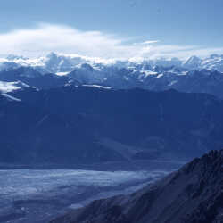
Kluane National Park, Yukon c.1958
A Glacier in the Kluane National Park in the Yukon c.1958 possibly The Donjek Glacier or Kaskawulsh Glacier
| Internal ID: | 0047.0253 |
|---|---|
| Medium: | Photograph |
| Date: | 1958 |
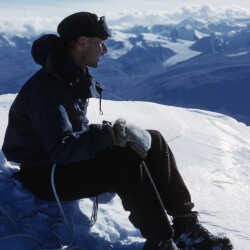
Summit of Mount Hoge
Kluane National Park, Yukon, 1958.
| Internal ID: | 0047.0254 |
|---|---|
| Medium: | Photograph |
| Date: | 1958 |
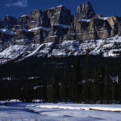
Castle Mountain c.April 1959
Castle Mountain c.April 1959: Castle Mountain is a mountain located within Banff National Park in the Canadian Rockies, approximately half-way between Banff and Lake Louise. It is the easternmost mountain of the Main Ranges in the Bow Valley and sits astride the Castle Mountain Fault which has thrust older sedimentary and metamorphic rocks forming the upper part of the mountain over the younger rocks forming its base. The mountain's castellated, or castle-like, appearance is a result of erosive processes acting at different rates on the peak's alternating layers of softer shale and harder limestone, dolomite and quartzite. The mountain was named in 1858 by James Hector for its castle-like appearance. From 1946 to 1979 it was known as Mount Eisenhower in honour of the World War II general Dwight D. Eisenhower. Public pressure caused its original name to be restored, but a pinnacle on the southeastern side of the mountain was named Eisenhower Tower. Located nearby are the remains of Silver City, a 19th-century mining settlement, and the Castle Mountain Internment Camp in which persons deemed enemy aliens and suspected enemy sympathizers were confined during World War I.
| Internal ID: | 0047.0258 |
|---|---|
| Medium: | Photograph |
| Date: | 1959 |
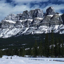
Castle Mountain c.April 1959
Castle Mountain c.April 1959: Castle Mountain is a mountain located within Banff National Park in the Canadian Rockies, approximately half-way between Banff and Lake Louise. It is the easternmost mountain of the Main Ranges in the Bow Valley and sits astride the Castle Mountain Fault which has thrust older sedimentary and metamorphic rocks forming the upper part of the mountain over the younger rocks forming its base. The mountain's castellated, or castle-like, appearance is a result of erosive processes acting at different rates on the peak's alternating layers of softer shale and harder limestone, dolomite and quartzite. The mountain was named in 1858 by James Hector for its castle-like appearance. From 1946 to 1979 it was known as Mount Eisenhower in honour of the World War II general Dwight D. Eisenhower. Public pressure caused its original name to be restored, but a pinnacle on the southeastern side of the mountain was named Eisenhower Tower. Located nearby are the remains of Silver City, a 19th-century mining settlement, and the Castle Mountain Internment Camp in which persons deemed enemy aliens and suspected enemy sympathizers were confined during World War I.
| Internal ID: | 0047.0259 |
|---|---|
| Medium: | Photograph |
| Date: | 1959 |
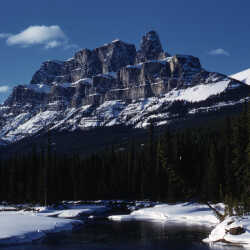
Castle Mountain c.April 1959
Castle Mountain c.April 1959: Castle Mountain is a mountain located within Banff National Park in the Canadian Rockies, approximately half-way between Banff and Lake Louise. It is the easternmost mountain of the Main Ranges in the Bow Valley and sits astride the Castle Mountain Fault which has thrust older sedimentary and metamorphic rocks forming the upper part of the mountain over the younger rocks forming its base. The mountain's castellated, or castle-like, appearance is a result of erosive processes acting at different rates on the peak's alternating layers of softer shale and harder limestone, dolomite and quartzite. The mountain was named in 1858 by James Hector for its castle-like appearance. From 1946 to 1979 it was known as Mount Eisenhower in honour of the World War II general Dwight D. Eisenhower. Public pressure caused its original name to be restored, but a pinnacle on the southeastern side of the mountain was named Eisenhower Tower. Located nearby are the remains of Silver City, a 19th-century mining settlement, and the Castle Mountain Internment Camp in which persons deemed enemy aliens and suspected enemy sympathizers were confined during World War I.
| Internal ID: | 0047.0260 |
|---|---|
| Medium: | Photograph |
| Date: | 1959 |
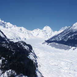
A glacier path c. April 1959
A glacier path c. April 1959 possibly one of the glaciers located near Mount Baker in the Waputik Mountains. The Waputik Mountains is a mountain range in the Canadian Rockies, located on the Continental Divide between Banff and Yoho National Park.
| Internal ID: | 0047.0264 |
|---|---|
| Medium: | Photograph |
| Date: | 1959 |
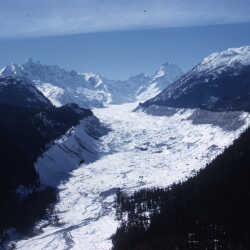
A glacier path c. April 1959
A glacier path c. April 1959 possibly one of the glaciers located near Mount Baker in the Waputik Mountains. The Waputik Mountains is a mountain range in the Canadian Rockies, located on the Continental Divide between Banff and Yoho National Park.
| Internal ID: | 0047.0265 |
|---|---|
| Medium: | Photograph |
| Date: | 1959 |
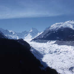
A glacier path c. April 1959
A glacier path c. April 1959 possibly one of the glaciers located near Mount Baker in the Waputik Mountains. The Waputik Mountains is a mountain range in the Canadian Rockies, located on the Continental Divide between Banff and Yoho National Park.
| Internal ID: | 0047.0266 |
|---|---|
| Medium: | Photograph |
| Date: | 1959 |
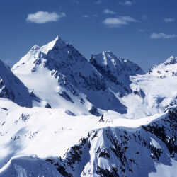
Mountain Peaks c. April 1959
Mountain Peaks c. April 1959 possibly located near Mount Baker in the Waputik Mountains. The Waputik Mountains is a mountain range in the Canadian Rockies, located on the Continental Divide between Banff and Yoho National Park.
| Internal ID: | 0047.0268 |
|---|---|
| Medium: | Photograph |
| Date: | 1959 |
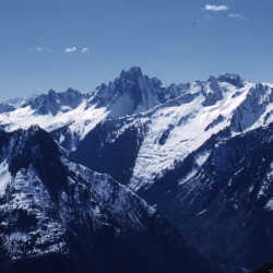
Mountain Peaks c. April 1959
Mountain Peaks c. April 1959 located near Mount Baker in the Waputik Mountains. The Waputik Mountains is a mountain range in the Canadian Rockies, located on the Continental Divide between Banff and Yoho National Park.
| Internal ID: | 0047.0269 |
|---|---|
| Medium: | Photograph |
| Date: | 1959 |
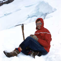
Marylin Hurst with her Ice Axe November 1959
Marylin Hurst, wife of Bill Hurst relaxing in the snow during a hike November 1959. Marylin was also a very accomplished climber, she shared in many of Bill's climbing adventures. Hiking and Climbing Mount Baker in the Waputik Mountains.
| Internal ID: | 0047.0285 |
|---|---|
| Medium: | Photograph |
| Date: | November 1st 1959 |
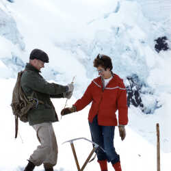
Marylin Hurst and fellow climber c.Nov 1959
Marylin Hurst and fellow climber c.Nov 1959. Hiking and Climbing Mount Baker in the Waputik Mountains.
| Internal ID: | 0047.0286 |
|---|---|
| Medium: | Photograph |
| Date: | 1959 |
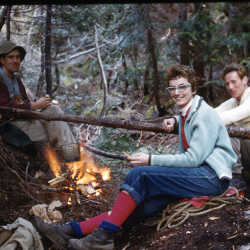
Base Camp Waputik Mountains Trip c.Nov.1959
Marylin Hurst and her fellow climbers at camp after along day of hiking c. Nov. 1959
| Internal ID: | 0047.0287 |
|---|---|
| Medium: | Photograph |
| Date: | 1959 |
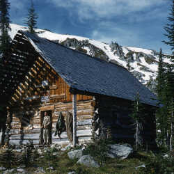
Kokanee Glacier Park Cabin June 1960
Kokanee Glacier Park Cabin June 1960
| Internal ID: | 0047.0315 |
|---|---|
| Medium: | Photograph |
| Date: | June 1st 1960 |
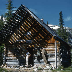
Kokanee Glacier Park Slocan Chief Cabin
June 1960
| Internal ID: | 0047.0316 |
|---|---|
| Medium: | Photograph |
| Date: | June 1st 1960 |
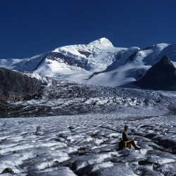
Robson Glacier August 1960
Marylin Hurst sitting on Robson Glacier in Mount Robson Provincial Park August 1960
| Internal ID: | 0047.0323 |
|---|---|
| Medium: | Photograph |
| Date: | 1960 |
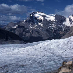
Mount Robson Glacier August 1960
Mount Robson Glacier August 1960
| Internal ID: | 0047.0325 |
|---|---|
| Medium: | Photograph |
| Date: | 1960 |
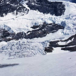
Mount Robson & Robson Glacier August 1960
Mount Robson & Robson Glacier August 1960
| Internal ID: | 0047.0326 |
|---|---|
| Medium: | Photograph |
| Date: | 1960 |
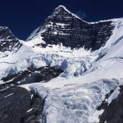
Mount Robson August 1960
Mount Robson August 1960, Looking up at Kain Face
| Internal ID: | 0047.0327 |
|---|---|
| Medium: | Photograph |
| Date: | 1960 |
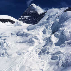
Mount Robson August 1960
Mount Robson August 1960
| Internal ID: | 0047.0328 |
|---|---|
| Medium: | Photograph |
| Date: | 1960 |
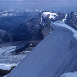
Robson Glacier August 1960
A view over looking Robson Glacier from the top of Mount Robson.
| Internal ID: | 0047.0329 |
|---|---|
| Medium: | Photograph |
| Date: | 1960 |
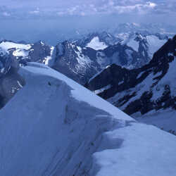
Mount Robson August 1960
A view over looking the valley from the top of Mount Robson August 1960
| Internal ID: | 0047.0330 |
|---|---|
| Medium: | Photograph |
| Date: | 1960 |
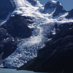
Berg Glacier August 1960
Berg Glacier August 1960. Berg Glacier is located on the North Face of Mount Robson. It feeds Robson Lake.
| Internal ID: | 0047.0331 |
|---|---|
| Medium: | Photograph |
| Date: | 1960 |
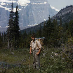
Mount Robson Provincial Park August 1960
Bill Hurst hiking thru Mount Robson Provincial Park August 1960
| Internal ID: | 0047.0332 |
|---|---|
| Medium: | Photograph |
| Date: | 1960 |
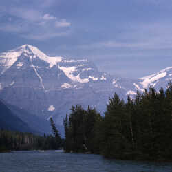
Mount Robson August 1960
Mount Robson August 1960 in Mount Robson Provincial Park
| Internal ID: | 0047.0333 |
|---|---|
| Medium: | Photograph |
| Date: | 1960 |
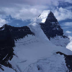
Mount Robson August 1960
Mount Robson August 1960
| Internal ID: | 0047.0334 |
|---|---|
| Medium: | Photograph |
| Date: | 1960 |
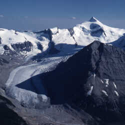
Robson Glacier August 1960
Robson Glacier August 1960
| Internal ID: | 0047.0335 |
|---|---|
| Medium: | Photograph |
| Date: | 1960 |
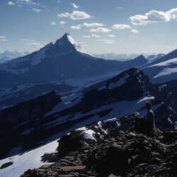
Mount Robson Provincial Park August 1960
Marylin Hurst sitting a top of a peak in Mount Robson Provincial Park August 1960. Do you recognize this peak, please let us know.
| Internal ID: | 0047.0336 |
|---|---|
| Medium: | Photograph |
| Date: | 1960 |
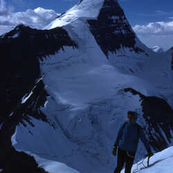
Resplendent Mountain August 1960
Marylin Clark climbing Resplendent Mountain with Mount Robson seen behind her August 1960
| Internal ID: | 0047.0337 |
|---|---|
| Medium: | Photograph |
| Date: | 1960 |
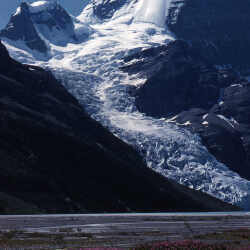
Berg Glacier August 1960
Berg Glacier from Berg Lake August 1960
| Internal ID: | 0047.0338 |
|---|---|
| Medium: | Photograph |
| Date: | 1960 |
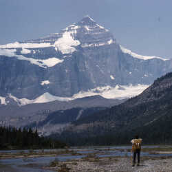
Whitehorn Mountain August 1960
Marylin Hurst looking at Whitehorn Mountain from Berg Lake Plateau located near Mount Robson August 1960
| Internal ID: | 0047.0339 |
|---|---|
| Medium: | Photograph |
| Date: | 1960 |
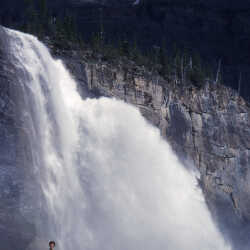
Emperor Falls August 1960
Marylin Hurst standing in front of Emperor Falls in Mount Robson Provincial Park August 1960. Emperor Falls is the largest and best known waterfall on the Robson River in Mount Robson Provincial Park. It is located a short distance downstream of and southwest from the outlet of Berg Lake.
| Internal ID: | 0047.0340 |
|---|---|
| Medium: | Photograph |
| Date: | 1960 |
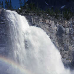
Emperor Falls August 1960
Emperor Falls in Mount Robson Provincial Park August 1960
| Internal ID: | 0047.0341 |
|---|---|
| Medium: | Photograph |
| Date: | 1960 |
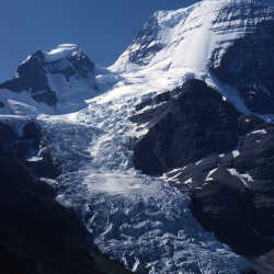
Berg Glacier & Berg Lake August 1960
Berg Glacier & Berg Lake August 1960
| Internal ID: | 0047.0342 |
|---|---|
| Medium: | Photograph |
| Date: | 1960 |
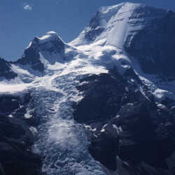
Berg Glacier & Berg Lake August 1960
Berg Glacier & Berg Lake taken from Mount Phillips August 1960
| Internal ID: | 0047.0343 |
|---|---|
| Medium: | Photograph |
| Date: | 1960 |
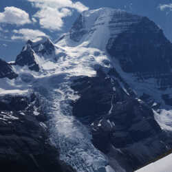
Berg Glacier & Berg Lake August 1960
Berg Glacier & Berg Lake taken from Mount Phillips August 1960
| Internal ID: | 0047.0344 |
|---|---|
| Medium: | Photograph |
| Date: | 1960 |
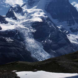
Mount Robson & Berg Glacier August 1960
Mount Robson & Berg Glacier taken from Mount Phillips August 1960
| Internal ID: | 0047.0345 |
|---|---|
| Medium: | Photograph |
| Date: | 1960 |
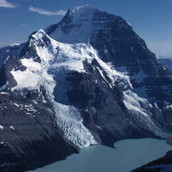
Mount Robson, Berg Glacier & Berg Lake August 1960
Mount Robson, Berg Glacier & Berg Lake taken from Mount Phillips August 1960
| Internal ID: | 0047.0346 |
|---|---|
| Medium: | Photograph |
| Date: | 1960 |
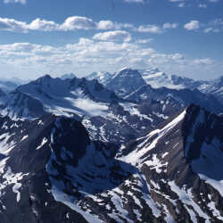
Mount Bess and Mount Chown August 1960
Mount Bess and Mount Chown in the distance possibly taken from the top of Mount Phillips located in Robson Provincial Park August 1960. Mount Bess is located on the continental divide at the head of Chown Creek and the Holmes River; north buttress of Bess Pass. on the border of Jasper & Mount Robson parks, Alberta/BC border. Major headwaters Smoky & Fraser rivers. Mount Chown is Alberta's 36th highest peak. It is named after the Reverend Samuel Dwight Chown. It is located in the northwest corner of Jasper National Park on the border with the Willmore Wilderness Park. It lies between two glaciers the Chown Glacier and the Resthaven Glacier.
| Internal ID: | 0047.0347 |
|---|---|
| Medium: | Photograph |
| Date: | 1960 |
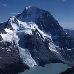
Mount Robson, Berg Glacier & Berg Lake August 1960
Mount Robson, Berg Glacier & Berg Lake taken from Mount Phillips August 1960
| Internal ID: | 0047.0348 |
|---|---|
| Medium: | Photograph |
| Date: | 1960 |
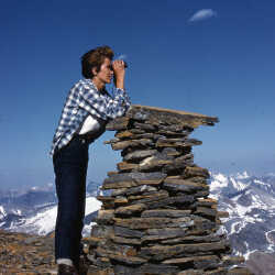
Mount Robson Provincial Park August 1960
Marylin Clark using binoculars to take in the view of Mount Robson Provincial Park August 1960
| Internal ID: | 0047.0349 |
|---|---|
| Medium: | Photograph |
| Date: | 1960 |
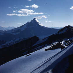
Mount Whitehorn August 1960
Mount Whitehorn located in the Mount Robson Provincial Park August 1960
| Internal ID: | 0047.0350 |
|---|---|
| Medium: | Photograph |
| Date: | 1960 |
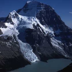
Mount Robson, Berg Glacier & Berg Lake
taken from Mount Phillips August 1960
| Internal ID: | 0047.0351 |
|---|---|
| Medium: | Photograph |
| Date: | 1960 |
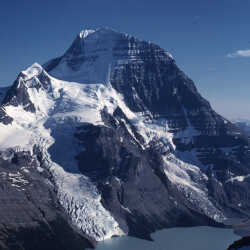
Mount Robson, Berg Glacier & Berg Lake August 1960
Mount Robson, Berg Glacier & Berg Lake taken from Mount Phillips August 1960
| Internal ID: | 0047.0352 |
|---|---|
| Medium: | Photograph |
| Date: | 1960 |
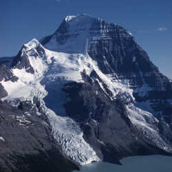
Mount Robson, Berg Glacier & Berg Lake August 1960
Mount Robson, Berg Glacier & Berg Lake taken from Mount Phillips August 1960
| Internal ID: | 0047.0353 |
|---|---|
| Medium: | Photograph |
| Date: | 1960 |
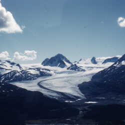
Reef Icefield from Snowbird Pass December 1960
Reef Icefield from Snowbird Pass December 1960
| Internal ID: | 0047.0357 |
|---|---|
| Medium: | Photograph |
| Date: | 1960 |
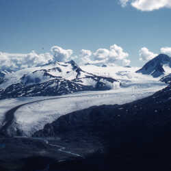
Reef Icefield from Snowbird Pass December 1960
Reef Icefield from Snowbird Pass December 1960
| Internal ID: | 0047.0358 |
|---|---|
| Medium: | Photograph |
| Date: | 1960 |
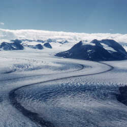
Reef Icefield from Snowbird Pass December 1960
Reef Icefield from Snowbird Pass December 1960
| Internal ID: | 0047.0359 |
|---|---|
| Medium: | Photograph |
| Date: | 1960 |
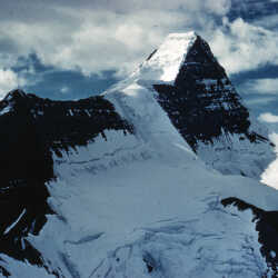
East face of Mount Robson c. December 1960
East face of Mount Robson from Resplendent Mountain c. December 1960
| Internal ID: | 0047.0372 |
|---|---|
| Medium: | Photograph |
| Date: | 1960 |
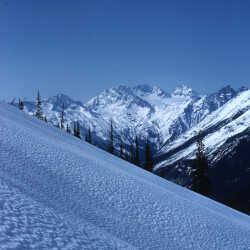
View From a Mountainside
A view from the side of a mountain above the treeline, early 1961. If you can help us identify where these mountains are, please let us know.
| Internal ID: | 0047.0387 |
|---|---|
| Medium: | Photograph |
| Date: | 1961 |

A Narrow Valley
A narrow draw between high mountain peaks, location unknown, early 1961.
| Internal ID: | 0047.0393 |
|---|---|
| Medium: | Photograph |
| Date: | 1961 |
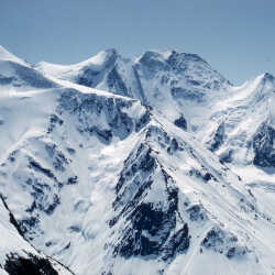
Alpine Peaks
Peaks high in an impressive mountain range, location unknown, early 1961. If you can help us identify any of these mountains, please let us know.
| Internal ID: | 0047.0394 |
|---|---|
| Medium: | Photograph |
| Date: | 1961 |
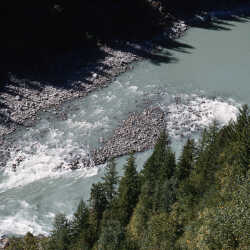
River From Above
Looking down on an unidentified river from a steep mountainside, 1961. Possibly somewhere in Washington State.
| Internal ID: | 0047.0414 |
|---|---|
| Medium: | Photograph |
| Date: | 1961 |
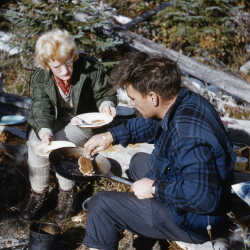
Bill Hurst Making Pancakes
1961
| Internal ID: | 0047.0415 |
|---|---|
| Medium: | Photograph |
| Date: | October 1st 1961 |