Subject: Maps

Lower Kootenay River Post Offices
A handdrawn map of post offices situated on the Lower Kootenay River.
| Internal ID: | 0039.0526 |
|---|---|
| Medium: | Photograph |
| Date: | 0000 |
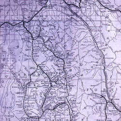
Map of Kootenay District, BC
Map of the Kootenay District, B.C.
| Internal ID: | 0131.0600 |
|---|---|
| Medium: | Map |
| Date: | 1912 |
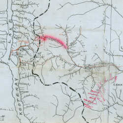
Hand Drawn Linen Map - Kaslo to Fort Steele
Hand drawn linen map of rivers and towns between Kaslo and Fort Steele.
| Internal ID: | 0247.0003 |
|---|---|
| Medium: | Map |
| Date: | 0000 |
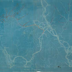
Blueprint Map of Kootenay River Drainage
Blueprint map covering area between Kaslo, B.C. & Roosville, B.C.
| Internal ID: | 0247.0006 |
|---|---|
| Medium: | Map |
| Date: | 0000 |

Map of SS Minto's Route
Taking up where the railroads leave off, the Minto traverses the 134-mile stretch of the Arrow Lakes. It was saved by the boom in British Columbia Canadaâ??s new â??Promised Land in the West.â?
| Internal ID: | 0248.0007 |
|---|---|
| Medium: | Photograph |
| Date: | April 1st 1949 |

Survey Maps: Fernie Townsite Addition 1906
Fernie Townsite Addition 1906
| Internal ID: | 2093.0003 |
|---|---|
| Medium: | Photograph |
| Date: | 1906 |

Survey Maps: Waldo School Site 1914
Waldo School Site 1914
| Internal ID: | 2093.0004 |
|---|---|
| Medium: | Photograph |
| Date: | 1914 |

Survey Maps: West Fernie 1926
West Fernie 1926
| Internal ID: | 2093.0005 |
|---|---|
| Medium: | Photograph |
| Date: | 1926 |

Survey Maps: Newgate 1953
Newgate 1953
| Internal ID: | 2093.0006 |
|---|---|
| Medium: | Photograph |
| Date: | 1953 |

Survey Maps: Elko School Site 1905
Elko School Site 1905
| Internal ID: | 2093.0007 |
|---|---|
| Medium: | Photograph |
| Date: | 1905 |

Survey Maps: Jaffray School Site undated
Jaffray School Site undated
| Internal ID: | 2093.0008 |
|---|---|
| Medium: | Photograph |
| Date: | 0000 |

Survey Maps: Sparwood 1955
Sparwood 1955
| Internal ID: | 2093.0009 |
|---|---|
| Medium: | Photograph |
| Date: | 1955 |

Survey Maps: Jaffray 1921
Jaffray 1912
| Internal ID: | 2093.0010 |
|---|---|
| Medium: | Photograph |
| Date: | 1912 |

Survey Maps: Elko undated
Elko undated
| Internal ID: | 2093.0011 |
|---|---|
| Medium: | Photograph |
| Date: | 0000 |

Survey Maps: Jaffray Subdivision Plans 1909
Jaffray Subdivision Plans 1909
| Internal ID: | 2093.0001 |
|---|---|
| Medium: | Photograph |
| Date: | 1909 |