Source: The Banff Windermere Highway pamphlet
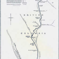
Sketch Map of the Banff-Windermere Road
A detailed sketch map of the route of the Banff-Windermere Highway, Castle Mountain to Radium Hot Springs. Details the auto and bungalow camps available on the route.
| Internal ID: | 0484.0006 |
|---|---|
| Medium: | Map |
| Date: | 1924 |
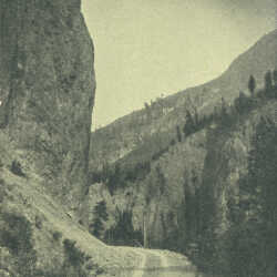
Sinclair Canyon
Sinclair Canyon at the western end of the Banff-Windermere Highway.
| Internal ID: | 0484.0008 |
|---|---|
| Medium: | Photograph |
| Date: | 1924 |
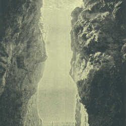
The Iron Gates
Nature's entrance to Kootenay National Park on the western end, formed by towers of red rock several hundred feet high. The banff-Windermere Highway passes through the Iron Gates.
| Internal ID: | 0484.0009 |
|---|---|
| Medium: | Photograph |
| Date: | 1924 |
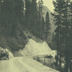
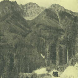
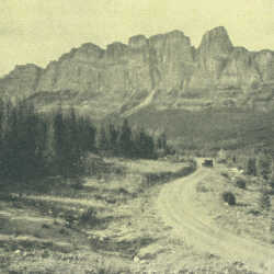
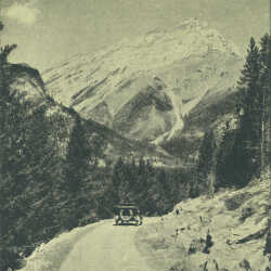
Near Sinclair Summit
The Banff-Windermere highway in 1924, approaching the Sinclair Summit.
| Internal ID: | 0484.0010 |
|---|---|
| Medium: | Photograph |
| Date: | 1924 |
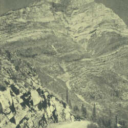
Top of Sinclair Summit
Shows a narrow track of unsurefaced road at the top of the Sinclair Summit on the Banff-Windermere highway. Such an insignificant looking trail, with a huge impact for the Kootenay-Columbia Valley.
| Internal ID: | 0484.0011 |
|---|---|
| Medium: | Photograph |
| Date: | 1924 |
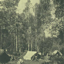
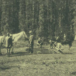
Camp at McLeod Meadows
The third of the wayside camps, coming from the west, on the Banff-Windermere Highway. This gives a sense of what auto touring was like in the earlier part of the 1920s.
| Internal ID: | 0484.0012 |
|---|---|
| Medium: | Photograph |
| Date: | 1924 |
Nearing Kootenay Crossing
This shows the original road descending to the Kootenay River and the bridge crossing there, approximately 28.5 miles from the western terminus of the road. At Kootenay Crossing there was an oil and gas station.
| Internal ID: | 0484.0013 |
|---|---|
| Medium: | Photograph |
| Date: | 1924 |
Kootenay River Near McLeod Meadows
The Kootenay River is gentle here, and relatively slow. It offered some of the most tranquil water for fishing on the North American continent when the Banff-Windermere road first opened.
| Internal ID: | 0484.0014 |
|---|---|
| Medium: | Photograph |
| Date: | 1924 |
The Paintpots
Located on Vermilion Plain, the Paintpots were natural deposits of ochre. The red pigment obtained here was used by First Nations people as paint for religious and other ceremonies.
| Internal ID: | 0484.0015 |
|---|---|
| Medium: | Photograph |
| Date: | 1924 |
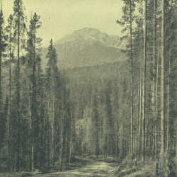
Castle Mountain
Castle Mountain from the Banff-Windermere highway in 1924. The view offers just a glimpse of the natural beauty that almost instantaneously made this road famous across North America and Europe.
| Internal ID: | 0484.0016 |
|---|---|
| Medium: | Photograph |
| Date: | 1924 |
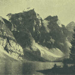
Moraine Lake
Moraine Lake in the Valley of the Ten Peaks. In 1924 Moraine Lake was on the 21 mile extension west into Lake Louise in Banff National Park and not strictly part of the Banff-Windermere highway itinerary.
| Internal ID: | 0484.0017 |
|---|---|
| Medium: | Photograph |
| Date: | 1924 |
Valley of the Ten Peaks
The majestic Valley of the Ten Peaks was accessed from the Castle-lake Louise extension from the Banff-Windermere highway. Located in Banff National Park it was another of the natural jewels that made the area magical to tourists.
| Internal ID: | 0484.0018 |
|---|---|
| Medium: | Photograph |
| Date: | 1924 |
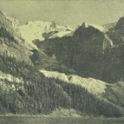
Moraine Lake
Glaciers draining into Moraine Lake. This is located on the Castle-Lake Louise extension of the Banff-Windermere Highway, in Banff National Park.
| Internal ID: | 0484.0019 |
|---|---|
| Medium: | Photograph |
| Date: | 1924 |
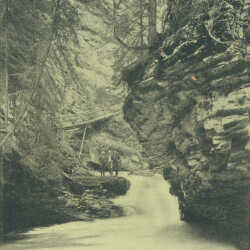
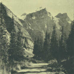
Johnston Canyon
Johnston Canyon is located between Castle Mountain and Banff on the Banff-Windermere Highway. It is located about half a mile up Johnston Creek from the highway.
| Internal ID: | 0484.0020 |
|---|---|
| Medium: | Photograph |
| Date: | 1924 |
Cascade Mountain
Cascade Mountain viewed from Tunnel Mountain, at Banff, Alberta.
| Internal ID: | 0484.0021 |
|---|---|
| Medium: | Photograph |
| Date: | 1924 |
Grotto Mountain
Grotto Mountain, near the East Gate.
| Internal ID: | 0484.0022 |
|---|---|
| Medium: | Photograph |
| Date: | 1924 |
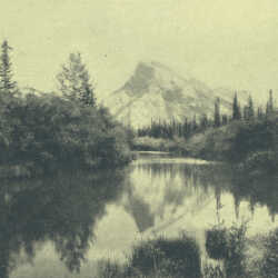
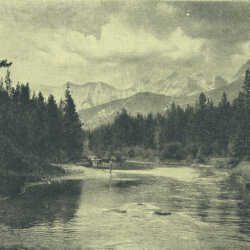
Mount Rundle
Mount Rundle seen from the Bow River in Banff National Park.
| Internal ID: | 0484.0023 |
|---|---|
| Medium: | Photograph |
| Date: | 1924 |
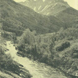
Pass Creek
Pass Creek in Waterton Lakes National Park,reached by the Transprovincial Highway over the Crowsnest Pass when doing the Grand Circle Tour.
| Internal ID: | 0484.0024 |
|---|---|
| Medium: | Photograph |
| Date: | 1924 |