Keyword: canyon

Hell's Gate on the Thompson River
Canadian National Railroad tunnel at Hell's Gate on the Thompson River. Sandy Czorny added: Canadian Northern Pacific Railway trestle and tunnel just east of Messiter, B.C. at Little Hell's Gate. K.Deckert added: This tunnel was located at Mile 12 Clearwater subdivision south of Blue River, BC. Due to the material it was unstable and water flowed and froze in it in the winter becoming a hazard. It was removed and the materiel used to fill in the trestle in the foreground. Possibly in the late 1950's early 60's
| Internal ID: | 0115.0014 |
|---|---|
| Medium: | Photograph |
| Date: | 0000 |

Railroad Bridge
Railroad bridge at Black Canyon on the Fraser River.
| Internal ID: | 0115.0017 |
|---|---|
| Medium: | Photograph |
| Date: | 0000 |

Fraser River Canyon
Fraser River at the canyon.
| Internal ID: | 0115.0021 |
|---|---|
| Medium: | Photograph |
| Date: | 0000 |

CN Railway Skoonka Tunnels
Skoonka Tunnels, Canadian National Main Line.
| Internal ID: | 0115.0024 |
|---|---|
| Medium: | Photograph |
| Date: | 0000 |

Peace River
May 21. Looking down along the Rocky Mountain canyon on the Peace River, upper part.
| Internal ID: | 0107.0026 |
|---|---|
| Medium: | Photograph |
| Date: | 0000 |

Goat River Canyon Bridges
Crows Nest Pass Railroad bridge and men on suspension foot bridge over Goat River Canyon, near Creston, B.C.
| Internal ID: | 0156.0026 |
|---|---|
| Medium: | Photograph |
| Date: | 1900 |

Bad Rapids at Rearguard
On back of photo - "A bad rapid at rearguard station at the upper Fraser river. The worst water I have seen. I think it worse than the canyon at Robson."
| Internal ID: | 0107.0028 |
|---|---|
| Medium: | Photograph |
| Date: | May 8th 1930 |

120th Meridian Boundary on the Peace River
Looking up Peace River where the 120th meridian, the boundary between BC and AB, crosses the river.
| Internal ID: | 0107.0030 |
|---|---|
| Medium: | Photograph |
| Date: | May 29th 1930 |

Fraser River
Fraser River
| Internal ID: | 0115.0030 |
|---|---|
| Medium: | Photograph |
| Date: | 0000 |

Peace River
Looking up Peace River near Dunvegan.
| Internal ID: | 0107.0031 |
|---|---|
| Medium: | Photograph |
| Date: | May 30th 1930 |

Peace River
Looking up Peace River.
| Internal ID: | 0107.0033 |
|---|---|
| Medium: | Photograph |
| Date: | May 30th 1930 |

Overlander Falls
Overlander Falls in Mount Robson Park on Fraser River.
| Internal ID: | 0107.0040 |
|---|---|
| Medium: | Photograph |
| Date: | 0000 |

Overlander Falls
Overlander Falls in Mount Robson Provincial Park on the Fraser River.
| Internal ID: | 0107.0042 |
|---|---|
| Medium: | Photograph |
| Date: | 0000 |

Rushing Waters
Steep river canyon with cascading water.
| Internal ID: | 0102.0066 |
|---|---|
| Medium: | Photograph |
| Date: | 0000 |

River Canyon
River canyon with railroad tracks clinging to bluffs.
| Internal ID: | 0102.0074 |
|---|---|
| Medium: | Photograph |
| Date: | 0000 |
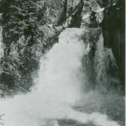
St. Leon Falls
The St. Leon Falls, situated near St. Leon on the Upper Arrow Lake, B.C.
| Internal ID: | 0131.0092 |
|---|---|
| Medium: | Postcard |
| Date: | 0000 |

Kootenay Paddlewheelers
Three boats ready in Jennings, MO and just waiting for high water to start their trips.
| Internal ID: | 0050.0207 |
|---|---|
| Medium: | Newspaper |
| Date: | April 12th 1898 |

Bull River Canyon, near Fernie, BC
Unused B&W real photo postcard of Bull River Canyon near Fernie, BC. AZO stampbox style in use 1924-1949.
| Internal ID: | 0039.0219 |
|---|---|
| Medium: | Postcard |
| Date: | 1930 |

Bull River Canyon, near Fernie, BC
Unused B&W real photo postcard of Bull River Canyon near Fernie, BC. AZO stampbox style in use 1924-1949.
| Internal ID: | 0039.0220 |
|---|---|
| Medium: | Postcard |
| Date: | 1930 |
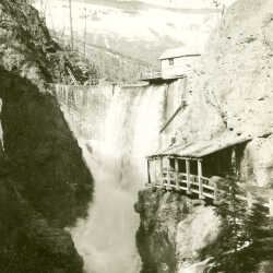
Mark Creek Dam
Mark Creek Dam and Spillway, Sullivan Mine, Kimberley, BC
| Internal ID: | 0205.0416 |
|---|---|
| Medium: | Photograph |
| Date: | May 1st 1933 |
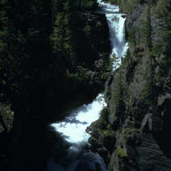
Meachen (Meachem) Creek Falls
Meachen (Meachem) Creek Falls, Kimberley, BC. This creek is believed to be named after Mr. William Meachem of Marysville, BC who owned a ranch and other property near the St. Mary's River in the early 1920's
| Internal ID: | 0205.0420 |
|---|---|
| Medium: | Photograph |
| Date: | 0000 |
Canyon Bluff
View of bluff in canyon, Valemount, BC
| Internal ID: | 0127.0594 |
|---|---|
| Medium: | Photograph |
| Date: | 0000 |

Canyon River
River flowing through canyon, Valemount, BC
| Internal ID: | 0127.0595 |
|---|---|
| Medium: | Photograph |
| Date: | 0000 |

Canyon River
Winter scene of river flowing through canyon, Valemount, BC
| Internal ID: | 0127.0596 |
|---|---|
| Medium: | Photograph |
| Date: | 0000 |

Canyon River
Winter scene of river flowing through canyon, Valemount, BC
| Internal ID: | 0127.0597 |
|---|---|
| Medium: | Photograph |
| Date: | 0000 |
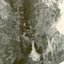
Canyon Floor on Highway 16 near the Fraser River
Looking down into canyon from wood barricade, Valemount, BC This photo was taken on Highway 16, east of Hwy 5 Fraser River crossing - adjacent to what was then Ministry of Highways commercial weigh scale (still in operation today).
| Internal ID: | 0127.0599 |
|---|---|
| Medium: | Photograph |
| Date: | 0000 |

Canyon Rapids
Canyon rapids of the Fraser River?
| Internal ID: | 0127.0608 |
|---|---|
| Medium: | Photograph |
| Date: | 0000 |
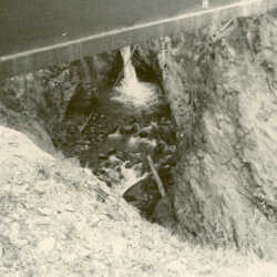
Canyon Floor
Looking at falls under bridge beam, Valemount area.
| Internal ID: | 0127.0611 |
|---|---|
| Medium: | Photograph |
| Date: | 0000 |
Crow's Nest Pass Hunting
Good hunting in Crow's Nest area.
| Internal ID: | 0051.0622 |
|---|---|
| Medium: | Newspaper |
| Date: | October 25th 1905 |
Banff-Windermere Highway
Banff-Windermere highway soon to be opened for public transport, but first a party of writers and camera men travelled the new road by pack train and describe the valleys, and natural beauties of the area.
| Internal ID: | 0052.0640 |
|---|---|
| Medium: | Newspaper |
| Date: | October 27th 1922 |
Potential of East Kootenay
Newspaper excerpt Vancouver World - describing the rich mining and farming available in East Kootenay, as well as the natural geography of the land.
| Internal ID: | 0051.0868 |
|---|---|
| Medium: | Newspaper |
| Date: | May 6th 1893 |
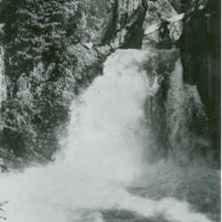
St. Leon Falls
The St. Leon Falls, situated near St. Leon on the Upper Arrow Lake, B.C.
| Internal ID: | 0131.0909 |
|---|---|
| Medium: | Postcard |
| Date: | 0000 |
Road Reconstruction
Ongoing road work on outlying areas in Cranbrook district nearing completion, and more work will be done on Kimberley/Windermere road once equipment being used in other construction gets freed up.
| Internal ID: | 0052.0914 |
|---|---|
| Medium: | Newspaper |
| Date: | May 8th 1930 |