Subject: Columbia Icefield
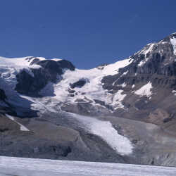
Athabasca Glacier August 22nd, 1965
Athabasca Glacier August 22nd, 1965 The Athabasca Glacier is one of the six principal 'toes' of the Columbia Icefield, located in the Canadian Rockies. The glacier currently recedes at a rate of about 5 metres (16 ft) per year and has receded more than 1.5 km (0.93 mi) and lost over half of its volume in the past 125 years. The glacier moves down from the icefield at a rate of several centimetres per day. Due to its close proximity to the Icefields Parkway, between the Alberta towns of Banff and Jasper, and rather easy accessibility, it is the most visited glacier in North America
| Internal ID: | 0047.0515 |
|---|---|
| Medium: | Photograph |
| Date: | August 22nd 1965 |
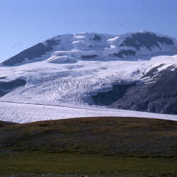
Andromeda Glacier August 22nd, 1965.
Andromeda Glacier August 22nd, 1965. Andromeda Glacier is located within the Columbia Icefield on the boundary of Banff and Jasper national parks. Located between Athabasca Glacier and Saskatchewan Glacier.
| Internal ID: | 0047.0516 |
|---|---|
| Medium: | Photograph |
| Date: | August 22nd 1965 |
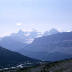
Mount Lyell August 22nd, 1965
Mount Lyell August 22nd, 1965. Mount Lyell is a mountain on the Alberta-British Columbia border, in western Canada. It is located on the Continental Divide, which forms the BC-Alberta boundary in this area, in Banff National Park. The mountain is the highest in the Lyell Group, a subrange of the Central Icefields in the Canadian Rockies. The mountain was named by James Hector in 1858 for the Scottish geologist Sir Charles Lyell.
| Internal ID: | 0047.0518 |
|---|---|
| Medium: | Photograph |
| Date: | August 22nd 1965 |
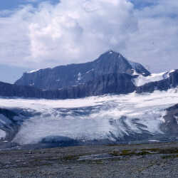
Mount Bryce August 22nd, 1965
Mount Bryce August 22nd, 1965 Mount Bryce is a mountain at the southwestern corner of the Columbia Icefield, in British Columbia near the border with Alberta. The mountain was named in 1898 by J. Norman Collie after Viscount James Bryce, who was President of the Alpine Club in London at the time. Mount Bryce is the fifteenth highest peak in British Columbia. However it is more notable for its large local relief above the nearby valleys to the south, east, and west. To the north it is connected by ridges to the Columbia Icefield. The mountain is rarely climbed due to difficult access although recently built logging roads are alleviating some of the access problems.
| Internal ID: | 0047.0519 |
|---|---|
| Medium: | Photograph |
| Date: | August 22nd 1965 |
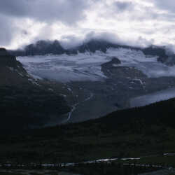
Castleguard Mountain & Glacier August 23, 1965
Castleguard Mountain & Glacier August 23, 1965
| Internal ID: | 0047.0520 |
|---|---|
| Medium: | Photograph |
| Date: | August 23rd 1965 |
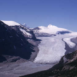
Saskatchewan Glacier August 17th, 1966
Primary source of the North Saskatchewan River
| Internal ID: | 0047.0535 |
|---|---|
| Medium: | Photograph |
| Date: | August 17th 1966 |
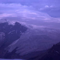
Snow Dome from Mount Bryce
Snow Dome from Mount Bryce July 31, 1988
| Internal ID: | 0047.1411 |
|---|---|
| Medium: | Photograph |
| Date: | 0000 |