Subject: National
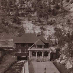
Radium Hot Springs Pool
An early image of the pool and pool house at Radium Hot Springs.
| Internal ID: | 0001.0010 |
|---|---|
| Medium: | Photograph |
| Date: | 1920 |
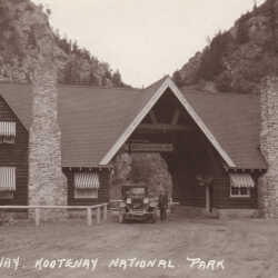
Kootenay National Park Gate
Postcard of the gateway entrance to Kootenay National Park.
| Internal ID: | 0001.0011 |
|---|---|
| Medium: | Postcard |
| Date: | 1925 |

The Lure Of The Mountains
The Mountains and the ways people interpret them.
| Internal ID: | 0042.0288 |
|---|---|
| Medium: | Newspaper |
| Date: | July 7th 1927 |
Game In East Kootenay
Historic description by C.M. Edwards.
| Internal ID: | 0051.0811 |
|---|---|
| Medium: | Newspaper |
| Date: | December 3rd 1936 |
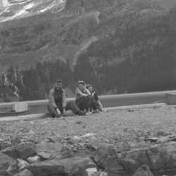
Constance Hope Gibson & Ethel Ada "Billie" Wadds June 1939
Constance Hope Gibson & cousin Ethel Ada "Billie" Wadds near Banff National Park June 1939
| Internal ID: | 2360.0035 |
|---|---|
| Medium: | Photograph |
| Date: | June 1st 1939 |
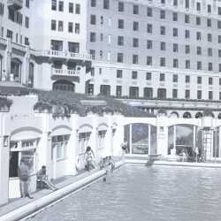
Banff Springs Hotel 1939
Banff Springs Hotel 1939
| Internal ID: | 2360.0110 |
|---|---|
| Medium: | Photograph |
| Date: | 1939 |
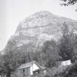
Yoho National Park 1941
Yoho National Park 1941
| Internal ID: | 2360.0160 |
|---|---|
| Medium: | Photograph |
| Date: | 1941 |
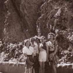
Radium Holiday
(L-R) Eleanor Willicome, Lou Willicome, Bessie Baines, Florie Wheaton, Kay Allan in Radium.
| Internal ID: | 0040.0053 |
|---|---|
| Medium: | Photograph |
| Date: | 0000 |
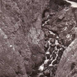
Sinclair Creek
Believed to be a view of Sinclair Creek in Kootenay National Park, just as it runs through Sinclair Canyon.
| Internal ID: | 0040.0079 |
|---|---|
| Medium: | Photograph |
| Date: | 0000 |
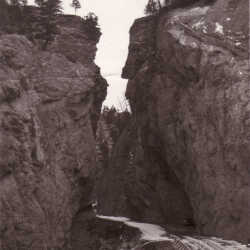
Sinclair Canyon
Believed to be an early view of the Banff-Windermere Highway thru Sinclair Canyon in Kootenay National Park, near Radium, B.C.
| Internal ID: | 0040.0080 |
|---|---|
| Medium: | Photograph |
| Date: | 0000 |
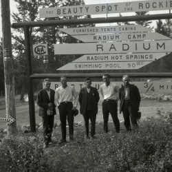
Radium Hot Springs Sign
Five unidentified men standing under a Radium Hot Springs sign.
| Internal ID: | 0336.0105 |
|---|---|
| Medium: | Photograph |
| Date: | 0000 |
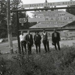
Radium Hot Springs Sign
Five unidentified men standing under a Radium Hot Springs sign.
| Internal ID: | 0336.0106 |
|---|---|
| Medium: | Photograph |
| Date: | 0000 |
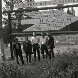
Radium Hot Springs Sign
Five unidentified men standing under a Radium Hot Springs sign.
| Internal ID: | 0336.0108 |
|---|---|
| Medium: | Photograph |
| Date: | 0000 |
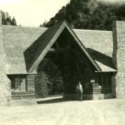
Kootenay National Park
Image of an unidentified man standing outside the western entrance to Kootenay National Park. Caption on the back reads: "Sinclair Hot Springs on the N.W. Rd." Later became Radium Hot Springs. This would be the western beginning of the Banff-Windermere Highway.
| Internal ID: | 0454.0043 |
|---|---|
| Medium: | Photograph |
| Date: | 1925 |
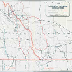
Canadian Rockies Circle Tour
This map shows the Banff-Windermere Highway as a portion of a larger circle tour that incorporates Calgary and Macleod, Alberta as well as Fort Steele, Windermere and Golden, B.C. Interestingly, Cranbrook is not on the map.
| Internal ID: | 0484.0007 |
|---|---|
| Medium: | Map |
| Date: | 1924 |
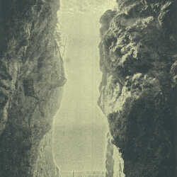
Sinclair Canyon
Sinclair Canyon at the western end of the Banff-Windermere Highway.
| Internal ID: | 0484.0008 |
|---|---|
| Medium: | Photograph |
| Date: | 1924 |
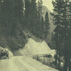
The Iron Gates
Nature's entrance to Kootenay National Park on the western end, formed by towers of red rock several hundred feet high. The banff-Windermere Highway passes through the Iron Gates.
| Internal ID: | 0484.0009 |
|---|---|
| Medium: | Photograph |
| Date: | 1924 |
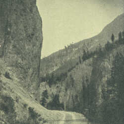
Near Sinclair Summit
The Banff-Windermere highway in 1924, approaching the Sinclair Summit.
| Internal ID: | 0484.0010 |
|---|---|
| Medium: | Photograph |
| Date: | 1924 |
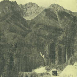
Top of Sinclair Summit
Shows a narrow track of unsurefaced road at the top of the Sinclair Summit on the Banff-Windermere highway. Such an insignificant looking trail, with a huge impact for the Kootenay-Columbia Valley.
| Internal ID: | 0484.0011 |
|---|---|
| Medium: | Photograph |
| Date: | 1924 |
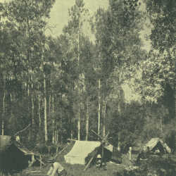
Camp at McLeod Meadows
The third of the wayside camps, coming from the west, on the Banff-Windermere Highway. This gives a sense of what auto touring was like in the earlier part of the 1920s.
| Internal ID: | 0484.0012 |
|---|---|
| Medium: | Photograph |
| Date: | 1924 |
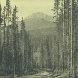
Nearing Kootenay Crossing
This shows the original road descending to the Kootenay River and the bridge crossing there, approximately 28.5 miles from the western terminus of the road. At Kootenay Crossing there was an oil and gas station.
| Internal ID: | 0484.0013 |
|---|---|
| Medium: | Photograph |
| Date: | 1924 |
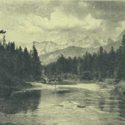
Kootenay River Near McLeod Meadows
The Kootenay River is gentle here, and relatively slow. It offered some of the most tranquil water for fishing on the North American continent when the Banff-Windermere road first opened.
| Internal ID: | 0484.0014 |
|---|---|
| Medium: | Photograph |
| Date: | 1924 |
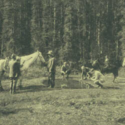
The Paintpots
Located on Vermilion Plain, the Paintpots were natural deposits of ochre. The red pigment obtained here was used by First Nations people as paint for religious and other ceremonies.
| Internal ID: | 0484.0015 |
|---|---|
| Medium: | Photograph |
| Date: | 1924 |
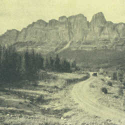
Castle Mountain
Castle Mountain from the Banff-Windermere highway in 1924. The view offers just a glimpse of the natural beauty that almost instantaneously made this road famous across North America and Europe.
| Internal ID: | 0484.0016 |
|---|---|
| Medium: | Photograph |
| Date: | 1924 |
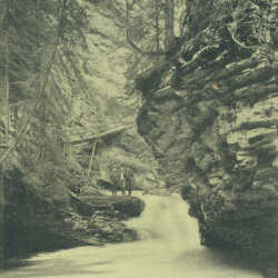
Johnston Canyon
Johnston Canyon is located between Castle Mountain and Banff on the Banff-Windermere Highway. It is located about half a mile up Johnston Creek from the highway.
| Internal ID: | 0484.0020 |
|---|---|
| Medium: | Photograph |
| Date: | 1924 |
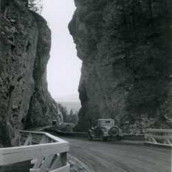
Sinclair Canyon, Kootenay National Park
Sinclair Canyon, Kootenay National Park by Radium Hot Springs
| Internal ID: | 2201.0007 |
|---|---|
| Medium: | Photograph |
| Date: | 0000 |
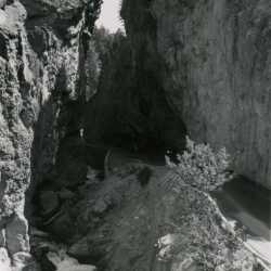
Sinclair Canyon near Radium Hot Springs, BC
Sinclair Canyon near Radium Hot Springs, BC Sinclair Canyon is on Banff-Windermere Hwy/Kootenay Hwy.
| Internal ID: | 2201.0011 |
|---|---|
| Medium: | Photograph |
| Date: | 0000 |
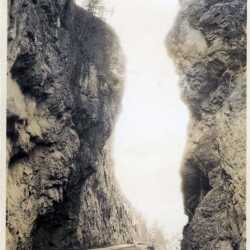
Sinclair Canyon, Kootenay National P[ark
Looking up in Sinclair Canyon, just past Radium, B.C. c. 1926
| Internal ID: | 2458.0021 |
|---|---|
| Medium: | Photograph |
| Date: | 1926 |
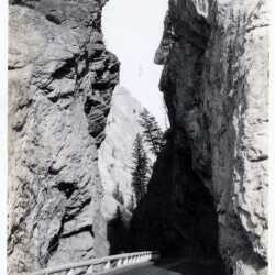
Sinclair Canyon, Kootenay National Park
The Banff-Windermere Highway passing through Sinclair Canyon in Kootenay National Park, c. 1935
| Internal ID: | 2458.0025 |
|---|---|
| Medium: | Photograph |
| Date: | 1935 |
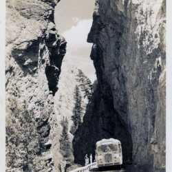
Bus in Sinclair Canyon, Kootenay National Park
A bus on the Banff-Windermere Highway passing through Sinclair Canyon c. 1935.
| Internal ID: | 2458.0033 |
|---|---|
| Medium: | Photograph |
| Date: | 1935 |
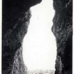
Entrance to Sinclair Canyon
Entrance to Sinclair Canyon in Kootenay National Park c. 1933, with the Banff-Windermere Highway passing through.
| Internal ID: | 2458.0035 |
|---|---|
| Medium: | Photograph |
| Date: | 1933 |
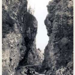
Passing Through Sinclair Canyon
A car on the Banff-Windermere Highway passing through Sinclair Canyon in Kootenay National Park c. 1933.
| Internal ID: | 2458.0037 |
|---|---|
| Medium: | Photograph |
| Date: | 1933 |
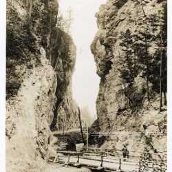
Sinclair Canyon, Kootenay National Park
Early Banff-Windermere Highway passing through Sinclair Canyon, c. 1928.
| Internal ID: | 2458.0045 |
|---|---|
| Medium: | Photograph |
| Date: | 1928 |
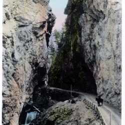
Banff-Windermere Highway Through Sinclair Canyon
Hand-coloured photo of the Banff-Windermere Highway passing through Sinclair Canyon at the entrance to Kootenay National Park, Sinclair Creek below the road c. 1928.
| Internal ID: | 2458.0047 |
|---|---|
| Medium: | Photograph |
| Date: | 1928 |
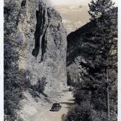
Passing the Iron Gate in Kootenay National Park
Banff-Windermere Highway passing the Iron Gate in Kootenay National Park, near Radium Hot Springs, c. 1955
| Internal ID: | 2458.0057 |
|---|---|
| Medium: | Photograph |
| Date: | 1955 |
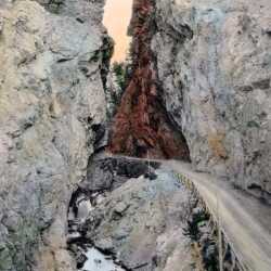
Banff-Windermere Highway Through Sinclair Canyon
A hand-coloured photograph of the new Banff-Windermere Highway through Sinclair Canyon, with Sinclair Creek below the road, c. 1925.
| Internal ID: | 2458.0067 |
|---|---|
| Medium: | Photograph |
| Date: | 1925 |
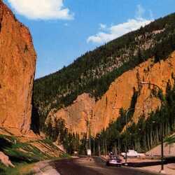
The Iron Gate in Kootenay National Park
A view of the Iron Gate, close to the source of water for the Radium Hot Springs pool, c. 1965.
| Internal ID: | 2458.0095 |
|---|---|
| Medium: | Photograph |
| Date: | 1965 |
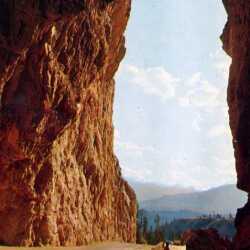
The Portals
The entrance to Sinclair Canyon, sometimes referred to as 'The Portals' to Kootenay National Park, c. 1960.
| Internal ID: | 2458.0103 |
|---|---|
| Medium: | Photograph |
| Date: | 1960 |
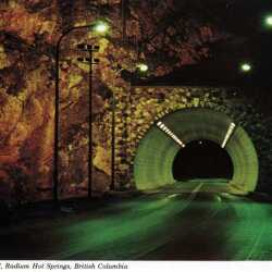
Iron Gate Tunnel
Interior view of the Iron Gate Tunnel, just inside the boundaries of Kootenay National Park near Radium Hot Springs, c. 1960. Photographer: Bruno Engler. . A Premiere card distributed by Canadian Souvenir Sales, Radium Hot Springs, B.C. #202/14310R. The legend reads: “IRON GATE TUNNEL” … Kootenay National Park, Radium Hot Springs, British Columbia, Canada. Evening view of the tunnel and the Redstreak Fault, just east of the world famous Radium Hot Springs Pool on Highway 93.”
| Internal ID: | 2458.0227 |
|---|---|
| Medium: | Photograph |
| Date: | 1960 |
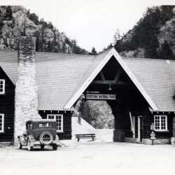
Entrance to Kootenay National P{ark
Entrance building to Kootenay National Park c. 1945,
| Internal ID: | 2566.0020 |
|---|---|
| Medium: | Photograph |
| Date: | 1945 |
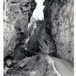
2566.0021
Approaching Sinclair Canyon in Kootenay National Park c. 1945, a portion of the Banff-Windermere Highway.
| Internal ID: | 2566.0021 |
|---|---|
| Medium: | Photograph |
| Date: | 1945 |
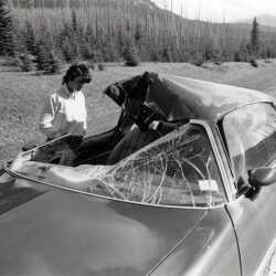
Moose Encounter In Park
A car wrecked by a moose in Kootenay National Park. One of the perils of the Banff-Windermere Highway. c. 1975.
| Internal ID: | 2465.0012 |
|---|---|
| Medium: | Photograph |
| Date: | 1975 |
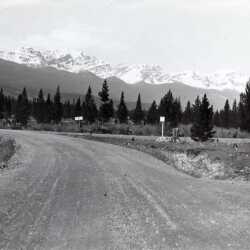
The Road Most Taken
The road junction to Windermere on the Banff-Windermere Highway in Kootenay National Park c. 1925.
| Internal ID: | 2465.0123 |
|---|---|
| Medium: | Photograph |
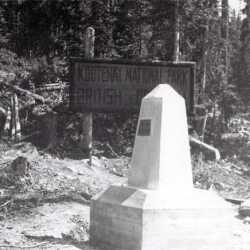
Great Divide Pillion
Kootenay National Park pillion on the Great Divide, marking the British Columbia/Alberta border c. 1925.
| Internal ID: | 2465.0124 |
|---|---|
| Medium: | Photograph |
| Date: | 1925 |
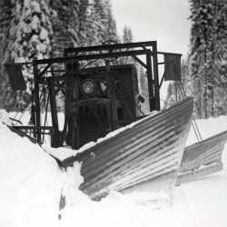
Snow Plow
Snow plow working on the Banff-Windermere Highway c. 1930.
| Internal ID: | 2465.0140 |
|---|---|
| Medium: | Photograph |
| Date: | 1930 |
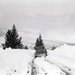
Banff-Windermere Highway
Banff-Windermere Highway through Kootenay National Park in winter, with car stuck, c. 1930.
| Internal ID: | 2465.0143 |
|---|---|
| Medium: | Photograph |
| Date: | 1930 |
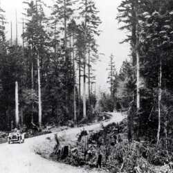
Banff-Windermere Highway c. 1925
A completed section of the Banff-Windermere Highway in Kootenay National Park c. 1925, shortly after opening.
| Internal ID: | 2465.0161 |
|---|---|
| Medium: | Photograph |
| Date: | 1925 |
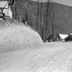
Banff-Windermere Highway Construction c. 1925.
A construction camp at Sinclair Pass on the Banff-Windermere Highway, c. 1925.
| Internal ID: | 2465.0162 |
|---|---|
| Medium: | Photograph |
| Date: | 1925 |
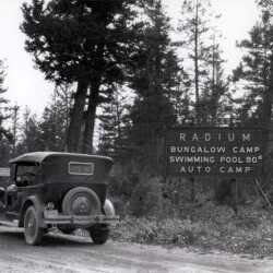
Coldstream Auto Camp
A 1927 Chev touring car on the Banff-Windermere Highway. The sign reads "Coldstream Auto Camp - Gas - Oil - Cabins - Supplies" and "Radium Bungalow Camp - Swimming Pool 90 (degrees) - Auto Camp".
| Internal ID: | 2465.0165 |
|---|---|
| Medium: | Photograph |
| Date: | 1930 |
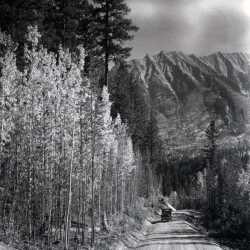
Banff-Windermere Highway
A section of the Banff-Windermere Highway in Kootenay National Park c. 1925. A new road to paradise.
| Internal ID: | 2465.0167 |
|---|---|
| Medium: | Photograph |
| Date: | 1925 |
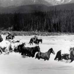
Crossing the Kootenay River
A pack train being driven across the Kootenay River inside Kootenay National Park c. 1925.
| Internal ID: | 2465.0176 |
|---|---|
| Medium: | Photograph |
| Date: | 1925 |
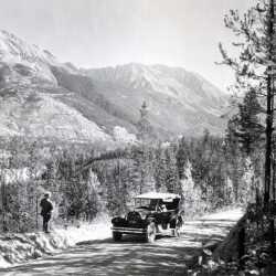
Touring Car Driver Enjoying the Beauty
A touring car on the Banff-Windermere Highway along the Vermillion River in Kootenay National Park, fall c. 1928.
| Internal ID: | 2465.0181 |
|---|---|
| Medium: | Photograph |
| Date: | 1928 |
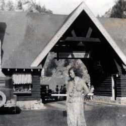
Violet Pepin c. 1930
Violet Pepin (nee Parkin) at Radium Hot Springs, B,C., c. 1930
| Internal ID: | 2465.0001 |
|---|---|
| Medium: | Photograph |
| Date: | 1930 |
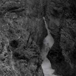
Sinclair Canyon Falls
Sinclair Canyon Falls in Kootenay National Park c. 1935
| Internal ID: | 2465.0002 |
|---|---|
| Medium: | Photograph |
| Date: | 1935 |
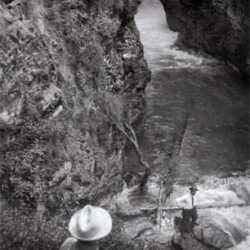
Sinclair Canyon Falls
Sinclair Canyon Falls in Kootenay National Park, c. 1935 (bottom portion of 2465.0002)
| Internal ID: | 2465.0003 |
|---|---|
| Medium: | Photograph |
| Date: | 1930 |
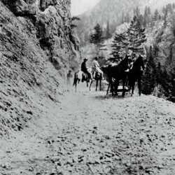
Construction of the Banff Windermere Highway, 1912
Construction beginning on the Banff Windermere Highway in Kootenay National Park, 1912. From the Golden Star, July 15, 1911 - "Minister Authorizes Prosecution of Survey - Hon. Thomas Taylor says that a Banff-Windermere Road will be completed this season. Sixty miles of highway construction developing."
| Internal ID: | 2465.0004 |
|---|---|
| Medium: | Photograph |
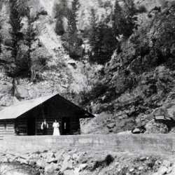
Bath House at Radium Hot Springs
Early bath house facility at Radium Hot Springs c. 1910
| Internal ID: | 2465.0006 |
|---|---|
| Medium: | Photograph |
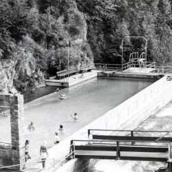
Radium Hot Springs Pool
View of Radium Hot Springs pool showing source pool at left and walkway over Sinclair Creek to temporary dressing room.
| Internal ID: | 2465.0007 |
|---|---|
| Medium: | Photograph |
| Date: | 1930 |
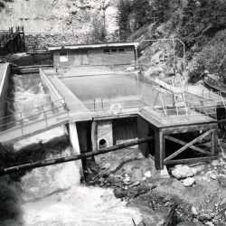
Radium Hot Springs Aquacourt
View of the Radium Hot Springs Aquacourt at the western entrance to Kootenay National Park.
| Internal ID: | 2465.0008 |
|---|---|
| Medium: | Photograph |
| Date: | 1950 |
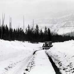
Banff-Windermere Highway
Driving the Banff-Windermere Highway in winter in Kootenay National Park, c. 1940.
| Internal ID: | 2465.0009 |
|---|---|
| Medium: | Photograph |
| Date: | 1940 |
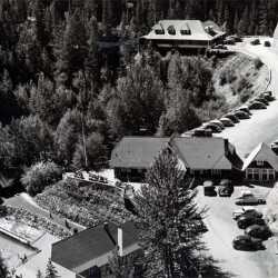
Radium Hot Springs Pool
Radium Hot Springs pool and bathhouse and gateway to Kootenay National Park c. 1948
| Internal ID: | 2465.0010 |
|---|---|
| Medium: | Photograph |
| Date: | 1948 |
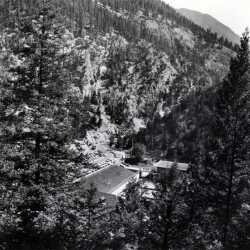
Radium Hot Springs Aquacourt c. 1955
An over view of the Radium Hot Springs pool and Aquacourt, c. 1955.
| Internal ID: | 2465.0011 |
|---|---|
| Medium: | Photograph |
| Date: | 1955 |
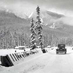
At Vermillion Crossing c. 1925
Old road at Vermillion Crossing in Kootenay National Park, with new bridge c.1925
| Internal ID: | 2465.0016 |
|---|---|
| Medium: | Photograph |
| Date: | 1925 |
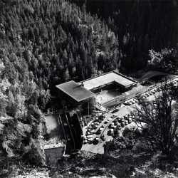
Radium Hot Springs Aquacourt
An overview of Radium Hot Springs Aquacourt and pool c. 1965
| Internal ID: | 2465.0017 |
|---|---|
| Medium: | Photograph |
| Date: | 1965 |
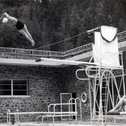
Radium Hot Springs Aquacourt, 1951
A high dive off the Aquacourt board during opening ceremonies for the new facility, 1951,
| Internal ID: | 2465.0018 |
|---|---|
| Medium: | Photograph |
| Date: | 1951 |
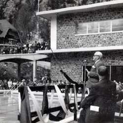
Radium Hot Springs Aquacourt
Opening ceremonies of the new Radium Hot Springs Aquacourt facility in Kootenay National Park, 1951
| Internal ID: | 2465.0019 |
|---|---|
| Medium: | Photograph |
| Date: | 1951 |
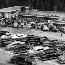
Parking Lot at Radium
Opening of the Radium Hot Springs Aquacourt seen from the parking lot, 1951
| Internal ID: | 2465.0020 |
|---|---|
| Medium: | Photograph |
| Date: | 1951 |
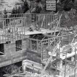
Radium Hot Springs Aquacourt
Construction of the pool building at the Radium Hot Springs Aquacourt, c. 1950. The sign says "Enjoy a bath in the radio-active waters of the government swimming pool - healthful and refreshing - temperature of 100 to 108 degrees Fahr."
| Internal ID: | 2465.0021 |
|---|---|
| Medium: | Photograph |
| Date: | 1950 |
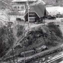
Radium Hot Springs Pool c. 1950
Construction of the new hot pool at Radium Hot Springs with the old townsite and the Kootenay National Park entrance in the background, c. 1950.
| Internal ID: | 2465.0023 |
|---|---|
| Medium: | Photograph |
| Date: | 1950 |
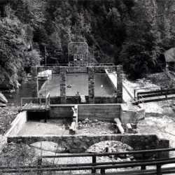
Radium Hot Springs Pool c. 1950
Radium Hot Springs pool development - old source pool at far left with ruins and foundation of old bath house in the foreground, temporary dressing room in the background across the creek at right, c. 1950.
| Internal ID: | 2465.0024 |
|---|---|
| Medium: | Photograph |
| Date: | 1950 |
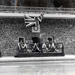
Radium Hot Springs Aquacourt, 1951
Opening ceremonies for the Radium Hot Springs Aquacourt complex, 3 p.m., 1951.
| Internal ID: | 2465.0026 |
|---|---|
| Medium: | Photograph |
| Date: | 1951 |
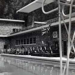
Radium Hot Springs Aquacourt, 1951
Opening ceremonies for the Radium Hot Springs Aquacourt complex, 3 p.m., 1951.
| Internal ID: | 2465.0027 |
|---|---|
| Medium: | Photograph |
| Date: | 1951 |