Keyword: highway
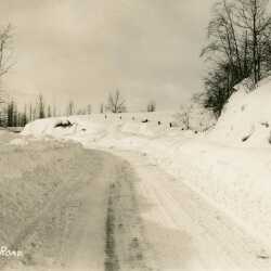
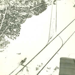
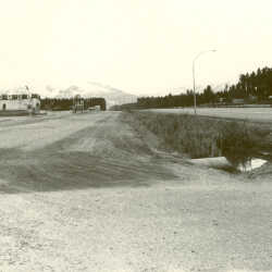
Rossland & Trail Highway January 1932
Rossland & Trail Highway (Highway 22) January 1932
| Internal ID: | 2313.0010 |
|---|---|
| Medium: | Photograph |
| Date: | 1932 |
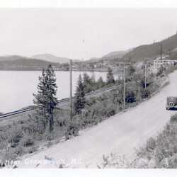
Moyie, B.C.
Real photographic postcard of highway approaching Moyie from the south, with the new Concentrator visible, c.1930. Printed cutline reads "Moyie Lake near Cranbrook, B.C."
| Internal ID: | 2491.0024 |
|---|---|
| Medium: | Photograph |
| Date: | 1930 |
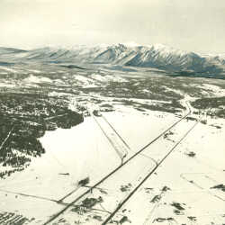
Aerial view of Cranbrook, B.C.
Aerial view of Cranbrook, B.C. airport, highway and railroad, ca. 1938
| Internal ID: | 0138.0029 |
|---|---|
| Medium: | Photograph |
| Date: | 1938 |
Aerial View of Lakit and Teepee Mountain
Aerial view of Cranbrook, B.C. airport, highway and railroad, ca. 1938; looking east with Lakit Mountain, Teepee Mountain and Wildhorse valley in distance. The Brewery on 6th street and I'm guessing the Airport building across the tracks and slightly North. It also shows the railway and road heading towards Kimberly, running parallel NW
| Internal ID: | 0138.0030 |
|---|---|
| Medium: | Photograph |
| Date: | 1938 |

Albertan Wreckless Driver
Newspaper article reporting on the accident that took place on the highway while a couple was traveling home from Spokane.
| Internal ID: | 0053.0056 |
|---|---|
| Medium: | Newspaper |
| Date: | August 4th 1927 |
Kimberley-Wasa Road
Newspaper article reporting that the proposed road from Cranbrook to Wasa was on it's way to construction.
| Internal ID: | 0053.0058 |
|---|---|
| Medium: | Newspaper |
| Date: | October 20th 1927 |
Board Of Trade Petitions
Cranbrook Board of Trade asks permission to erect welcome arches on main highway at either end of city.
| Internal ID: | 0053.0093 |
|---|---|
| Medium: | Newspaper |
| Date: | August 21st 1930 |
Window Decorator
Cranbrook window decorator becoming known for his refusal to eat anyone's dust.
| Internal ID: | 0053.0123 |
|---|---|
| Medium: | Newspaper |
| Date: | September 11th 1930 |
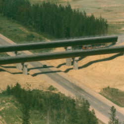
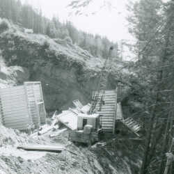
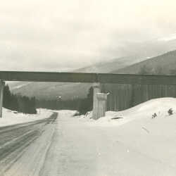
Twin Overpasses
Two overpasses under construction over an existing highway, thought to be in the Valemount area.
| Internal ID: | 0119.0173 |
|---|---|
| Medium: | Photograph |
| Date: | 0000 |
Highway 5 Construction
Highway 5 road construction, with Mt. Robson in the background, 1965. Present sight (2000)of the view point and rest stop where the goat is.
| Internal ID: | 0070.0179 |
|---|---|
| Medium: | Photograph |
| Date: | 1965 |
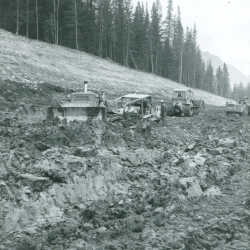
Highway 5 Construction
Highway 5 construction, showing scrapers in use at Tete Jaune, close to Kenny Abernathie's mill site near Swift Current creek, 1966.
| Internal ID: | 0070.0180 |
|---|---|
| Medium: | Photograph |
| Date: | 1966 |
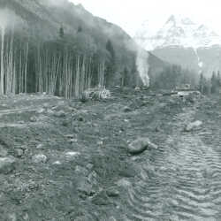
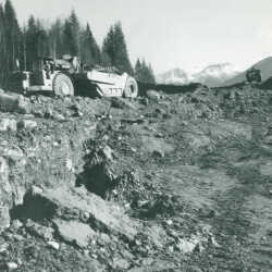
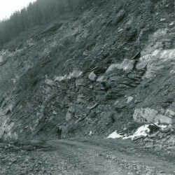
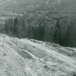
Highway 5 Construction
Highway 5 construction at the "mud cut" a mile east of Tete Jaune, 1965.
| Internal ID: | 0070.0181 |
|---|---|
| Medium: | Photograph |
| Date: | 1965 |
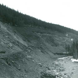
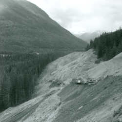
Highway 5 Construction
Highway 5 construction at Shale Hill area & the Fraser River, 1966.
| Internal ID: | 0070.0182 |
|---|---|
| Medium: | Photograph |
| Date: | 1966 |
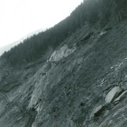
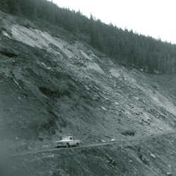
Highway 5 Construction
Highway 5 construction at Shale Hill, 1966. Note the old highway at lower left corner of photo.
| Internal ID: | 0070.0183 |
|---|---|
| Medium: | Photograph |
| Date: | 1966 |
Highway 5 Construction
Highway 5 construction at Shale Hill, 1966, with old road visible.
| Internal ID: | 0070.0184 |
|---|---|
| Medium: | Photograph |
| Date: | 1966 |
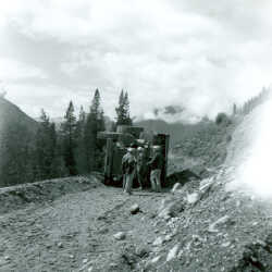
Highway 5 Construction
Highway 5 construction wit the rock wagon on its side, 1966.
| Internal ID: | 0070.0185 |
|---|---|
| Medium: | Photograph |
| Date: | 1966 |
Highway 5 Construction
Highway 5 construction at the Shale Hill area, 1966.
| Internal ID: | 0070.0186 |
|---|---|
| Medium: | Photograph |
| Date: | 1966 |
Highway 5 Construction
Highway 5 construction east of Mt. Robson, 1966.
| Internal ID: | 0070.0187 |
|---|---|
| Medium: | Photograph |
| Date: | 1966 |
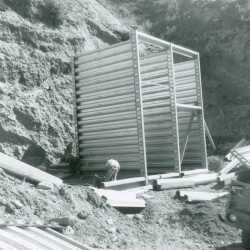
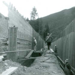
Highway 5 Construction
Highway 5 construction, building a Bin Wall east of Mt. Robson, 1967.
| Internal ID: | 0070.0188 |
|---|---|
| Medium: | Photograph |
| Date: | 1967 |
Highway 5 Construction
Highway 5 construction, building a bin wall east of Mt. Robson, 1967.
| Internal ID: | 0070.0189 |
|---|---|
| Medium: | Photograph |
| Date: | 1967 |
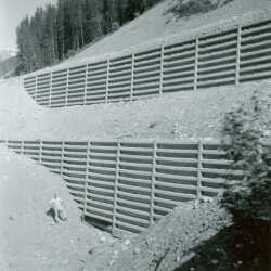
Highway 5 Construction
Highway 5 construction, building a bin wall east of Mt. Robson, 1967.
| Internal ID: | 0070.0190 |
|---|---|
| Medium: | Photograph |
| Date: | 1967 |
Highway 5 Construction
Highway 5 construction, T.M.O.P.L x-ing 1967 east of Mt.Robson.
| Internal ID: | 0070.0191 |
|---|---|
| Medium: | Photograph |
| Date: | 1967 |
Highway 5 Construction
Highway 5 construction. T.M.O.P.L. box culvert construction for oil line crossing that highway passes over. Approximately five miles east of Mt.Robson. Inside measures 477 feet long, 16 feet wide and six to twelve feet high.
| Internal ID: | 0070.0192 |
|---|---|
| Medium: | Photograph |
| Date: | 1967 |
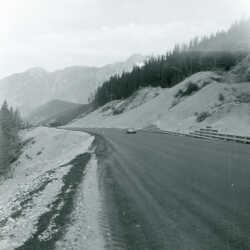
Highway 5 Construction
Highway 5 construction, with new asphalt east of Mt. Robson, 1968.
| Internal ID: | 0070.0193 |
|---|---|
| Medium: | Photograph |
| Date: | 1968 |
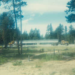
Highway 5 Construction
Steve Froescul and Mike Osadchuk moved these heavy concrete beams from the railroad to Swift Creek for the bridge during the HIghway 5 construction in 1965 and 1966.
| Internal ID: | 0070.0213 |
|---|---|
| Medium: | Photograph |
| Date: | 1965 |
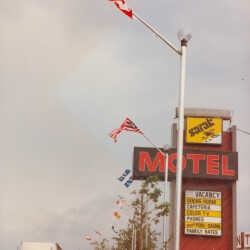
Truck Run
Main highway, lined with flags, runs past Sarak Motel, Valemount, BC
| Internal ID: | 0127.0291 |
|---|---|
| Medium: | Photograph |
| Date: | 1980 |
Motel
Presumed a photo of highway that passes by motel, Valemount, BC
| Internal ID: | 0127.0332 |
|---|---|
| Medium: | Photograph |
| Date: | 1980 |
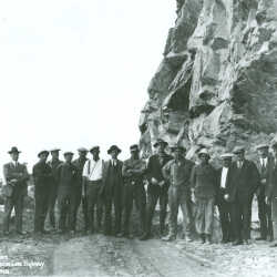
Slocan Lake Highway
Completion of the Slocan Lake Highway 6 at Cape Horn bluffs. Left to right - H.H. Currie; Alex G. Ewing; Harry Clark; E.B.S. Brown; Guy Davis; A.L. Blackberg; Harvey Fife; Jack McKay; W.B. Johnstone; Harry Olsen; G. Montfort; Charles Barber; Wm. Ramsay; A.L. Carruthers; L.H. Rawlings and O.P. Roberts
| Internal ID: | 0131.0523 |
|---|---|
| Medium: | Photograph |
| Date: | June 5th 1928 |
Kimberley Board Of Trade
Regular monthly meeting of Kimberley Board of Trade, touching on the subject of paving the southern trans-provincial highway and starting to prepare for relief and donations to Kimberleys unemployed.
| Internal ID: | 0050.0538 |
|---|---|
| Medium: | Newspaper |
| Date: | December 10th 1931 |
Highway 5 construction
Highway 5 construction, Valemount to Tete Jaune Cache, BC.
| Internal ID: | 0127.0546 |
|---|---|
| Medium: | Photograph |
| Date: | 1969 |
Banff-Windermere Highway
Banff-Windermere highway soon to be opened for public transport, but first a party of writers and camera men travelled the new road by pack train and describe the valleys, and natural beauties of the area.
| Internal ID: | 0052.0640 |
|---|---|
| Medium: | Newspaper |
| Date: | October 27th 1922 |
Grubbe & McQuaid Resign
Cranbrook Board of Trade meeting discusses traffic signs and resignation of two members.
| Internal ID: | 0050.0710 |
|---|---|
| Medium: | Newspaper |
| Date: | October 16th 1930 |
Kimberley-Wasa Highway
Construction of the bridge over Cherry Creek on the Kimberley-Wasa highway is finished.
| Internal ID: | 0050.0722 |
|---|---|
| Medium: | Newspaper |
| Date: | October 23rd 1930 |
Moyie Autoists
Comings and going of Moyie residents and visitors, with note of surveying for paved highway three miles on each side of Moyie.
| Internal ID: | 0051.0807 |
|---|---|
| Medium: | Newspaper |
| Date: | June 11th 1936 |
Auto Tourist Conditions
After official opening Banff-Windermere highway has proved a great pleasure to ever increasing number of tourists travelling it.
| Internal ID: | 0051.0914 |
|---|---|
| Medium: | Newspaper |
| Date: | July 27th 1923 |
Government Offices
The government offices for East Kootenay, south division, moved from Fort Steele to Cranbrook May 1904. Each department is listed out to what they have to deal with.
| Internal ID: | 0050.0929 |
|---|---|
| Medium: | Newspaper |
| Date: | December 1st 1904 |
Tourist Park Marketing
Article stating both side of the issue of Cranbrook withdrawing from the Tourist Association and advertising on its own.
| Internal ID: | 0051.0932 |
|---|---|
| Medium: | Newspaper |
| Date: | August 10th 1923 |