Cranbrook Archives: 0138
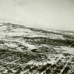
Cranbrook, B.C. from the Air, 1938
Cranbrook, B.C. from the air, 1938.
| Internal ID: | 0138.0001 |
|---|---|
| Medium: | Photograph |
| Date: | 1938 |
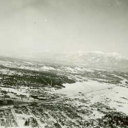
Cranbrook, B.C. from the Air, 1938
Cranbrook, B.C. from the air, 1938, with Lakit Mountain in distance.
| Internal ID: | 0138.0002 |
|---|---|
| Medium: | Photograph |
| Date: | 1938 |
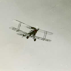
Bi-plane Identification CF-AGK.
Bi-plane identification CF-AGK in flight, Cranbrook, BC. A de Havilland 60 Moth owned by Radium Hot Springs Flying Service Ltd.
| Internal ID: | 0138.0003 |
|---|---|
| Medium: | Photograph |
| Date: | 1940 |
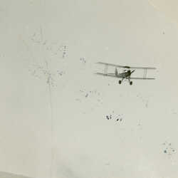
Bi-plane CF-AGK Flying over Cranbrook, c. 1939
Bi-plane identification CF-AGK Cranbrook, BC, c. 1939. A de Havilland 60 Moth owned by Radium Hot Springs Flying Service Ltd. flew from 1929 to 1940.
| Internal ID: | 0138.0004 |
|---|---|
| Medium: | Photograph |
| Date: | 1939 |
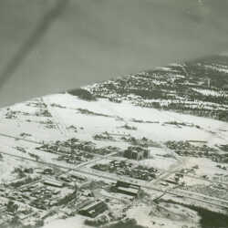
Cranbrook, B.C. from the air, 1938
Cranbrook, B.C. from the air, 1938, this photo is aimed North East and captures Central School in the middle and the Baker Home in the far Right edge
| Internal ID: | 0138.0005 |
|---|---|
| Medium: | Photograph |
| Date: | 1938 |
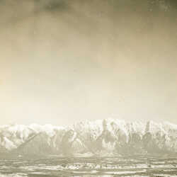
Lone Peak and Lakit Mountain and the Steeples Range
View of Rockies, Lone Peak and Lakit Mountain from 3000 ft. altitude, near Fort Steele, B.C., 1938.
| Internal ID: | 0138.0006 |
|---|---|
| Medium: | Photograph |
| Date: | 1938 |
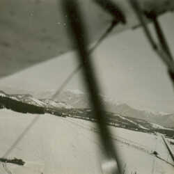
Airport runway, ca. 1938, Cranbrook, B.C.
Creanbrook airport runway from the air, ca 1938.
| Internal ID: | 0138.0007 |
|---|---|
| Medium: | Photograph |
| Date: | 1938 |
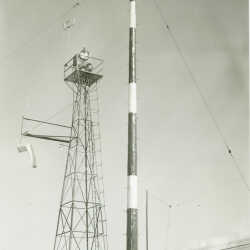
Beacon, Wind Sock and Radio Tower, ca. 1938
Beacon, wind sock and radio tower at the Cranbrook airport, ca. 1938.
| Internal ID: | 0138.0008 |
|---|---|
| Medium: | Photograph |
| Date: | 1938 |
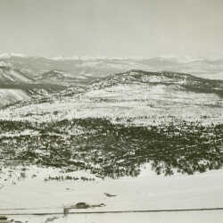
Selkirk Mountains Cranbrook, BC
Aerial view from Cranbrook, B.C. of Selkirk Mountains, west of Cranbrook ( St. Eugene Hospital in foreground ) ca. 1938.
| Internal ID: | 0138.0009 |
|---|---|
| Medium: | Photograph |
| Date: | 1938 |
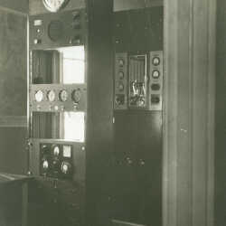
TCA speaker
Airport - TCA speaker and equipment, Cranbrook, B.C. ca. 1938
| Internal ID: | 0138.0010 |
|---|---|
| Medium: | Photograph |
| Date: | 1938 |
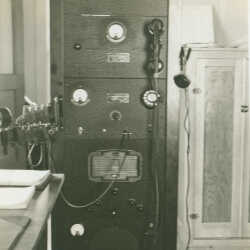
TCA Transmitter
Airport TCA transmitter ( radio equipment )Cranbrook, BC ca. 1938
| Internal ID: | 0138.0011 |
|---|---|
| Medium: | Photograph |
| Date: | 1938 |
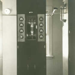
Radio Equipment
Airport - Dept. of Transport instruments (radio equipment) installed at Cranbrook, B.C. ca. 1938
| Internal ID: | 0138.0012 |
|---|---|
| Medium: | Photograph |
| Date: | 1938 |
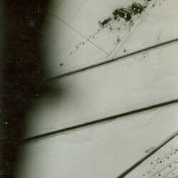
Aerial View of Cranbrook Airport Runway
Aerial view - Airport runway and area at Cranbrook, B.C. ca 1938
| Internal ID: | 0138.0013 |
|---|---|
| Medium: | Photograph |
| Date: | 1938 |
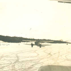
De Havilland biplane on the runway, Cranbrook Airport
A De Havilland D.H. 89 Dragon Rapide on the runway at the Cranbrook Airport, ca. 1938.
| Internal ID: | 0138.0014 |
|---|---|
| Medium: | Photograph |
| Date: | 1938 |
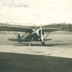
Waco biplane at Cranbrook Airport
A late production Waco custom cab biplane at airport, Cranbrook, BC ca 1950
| Internal ID: | 0138.0015 |
|---|---|
| Medium: | Photograph |
| Date: | 1950 |
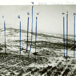
Aerial view of Cranbrook, B.C.
Aerial view of Cranbrook, B.C., ca. 1938; Numbers on photo correspond to - #1-CPR, #2-Armouries, #3-Hospital, #4-Hotel, #5-Gyro Park, #6-Public School, #7-Government Buildings, #8-Arena, #9-Brewery, #10-Airport.
| Internal ID: | 0138.0016 |
|---|---|
| Medium: | Photograph |
| Date: | 1938 |
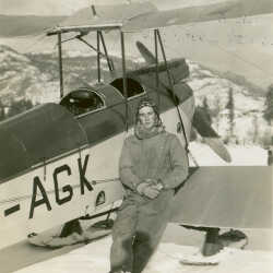
Pilot Jock Blakley and his De Havilland DH60 Moth
Cranbrook, B.C. Airport, Aviator and Bi-plane on the ground, identification CF-AGK, ca. 1938. A de Havilland 60 Moth owned by Radium Hot Springs Flying Service Ltd. flew from 1929 to 1940.
| Internal ID: | 0138.0017 |
|---|---|
| Medium: | Photograph |
| Date: | 1938 |
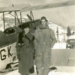
Aviator and Bi-plane
On the ground at the Cranbrook airport, ca. 1938. CF-AGK was a DH.60M Moth owned by Capt. John Blakley of Radium Hot Springs. The plane was registered in 1929 and was destroyed in a crash near Windermere in 1940. The aviator is his son Jock Blakley. The woman is Jock's mother Jesse Blakley.
| Internal ID: | 0138.0018 |
|---|---|
| Medium: | Photograph |
| Date: | 1938 |
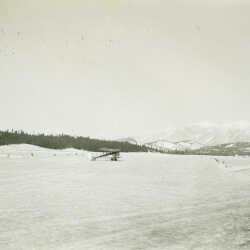
Bi-plane at Cranbrook Airport, c. 1938
Bi-plane identification CF-AGK, ca. 1938, at airport Cranbrook, B.C.
| Internal ID: | 0138.0019 |
|---|---|
| Medium: | Photograph |
| Date: | 1938 |
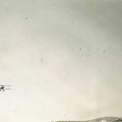
Bi-plane airborne, approaching Cranbrook Airport
Bi-plane airborne at Cranbrook, B.C. airport, ca. 1938.
| Internal ID: | 0138.0020 |
|---|---|
| Medium: | Photograph |
| Date: | 1938 |
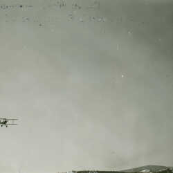
Bi-plane airborne Over Cranbrook Airport
Bi-plane airborne at Cranbrook, B.C. airport ca. 1938.
| Internal ID: | 0138.0021 |
|---|---|
| Medium: | Photograph |
| Date: | 1938 |
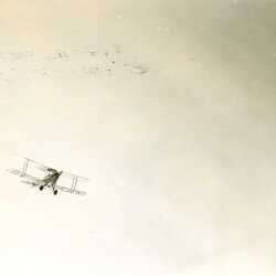
Bi-plane Airborne Over Cranbrook Airport
Bi-plane airborne at Cranbrook, B.C. airport ca. 1938.
| Internal ID: | 0138.0022 |
|---|---|
| Medium: | Photograph |
| Date: | 1938 |
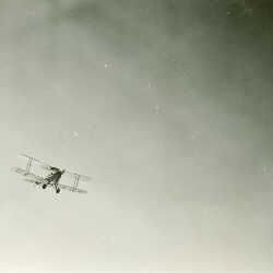
Bi-plane airborne
Bi-plane airborne at Cranbrook, B.C. airport ca. 1938.
| Internal ID: | 0138.0023 |
|---|---|
| Medium: | Photograph |
| Date: | 1938 |
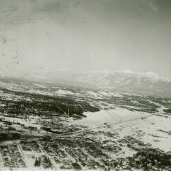
Aerial View of Cranbrook, B.C., c. 1938
Aerial view of Cranbrook, B.C. ca. 1938, with snow-covered mountains showing to the east.
| Internal ID: | 0138.0024 |
|---|---|
| Medium: | Photograph |
| Date: | 1938 |
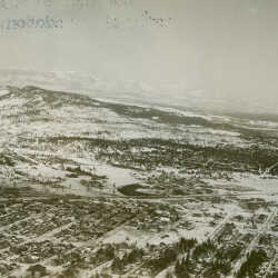
Aerial View of Cranbrook, B.C., c. 1938
Aerial view of Cranbrook, B.C. ca. 1938, with snow-covered Selkirk mountains to the west
| Internal ID: | 0138.0025 |
|---|---|
| Medium: | Photograph |
| Date: | 1938 |
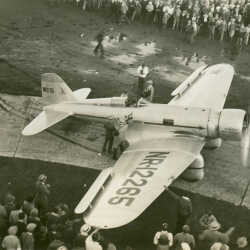
Northrop Gamma 2A Texaco Sky Chief, single-engine aircraft at Cranbrook Airport
Pilot and single-engine aircraft called Sky Chief identification number NR-12265 on display before crowd of people at Cranbrook airport, ca. 1940. Larry Belzac added: Aircraft is a Northrop Gamma 2A "Texaco Sky Chief".
| Internal ID: | 0138.0026 |
|---|---|
| Medium: | Photograph |
| Date: | 1940 |
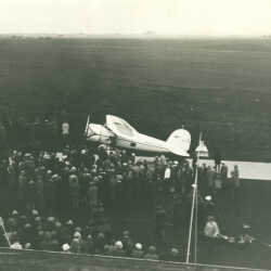
Lockheed Vega "Winnie Mae" at Edmonton Airport, c. 1940
Single-engine aircraft called "Winnie Mae" on display before crowd of people at the Edmonton airport, ca. 1940. Larry Belzak added: Aircraft is a Lockheed Vega "Winnie Mae". Wiley Post, famed American aviator set many records and pioneered several aviation technologies with this aircraft.
| Internal ID: | 0138.0027 |
|---|---|
| Medium: | Photograph |
| Date: | 1940 |
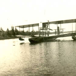
Pontoon Push-prop Bi-plane on a Lake
Pontoon single-engine push-prop bi-plane docked on water, possibly Moyie Lake, ca. 1935.
| Internal ID: | 0138.0028 |
|---|---|
| Medium: | Photograph |
| Date: | 1935 |
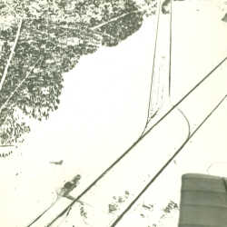
Aerial view of Cranbrook, B.C.
Aerial view of Cranbrook, B.C. airport, highway and railroad, ca. 1938
| Internal ID: | 0138.0029 |
|---|---|
| Medium: | Photograph |
| Date: | 1938 |
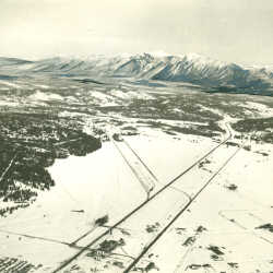
Aerial View of Lakit and Teepee Mountain
Aerial view of Cranbrook, B.C. airport, highway and railroad, ca. 1938; looking east with Lakit Mountain, Teepee Mountain and Wildhorse valley in distance. The Brewery on 6th street and I'm guessing the Airport building across the tracks and slightly North. It also shows the railway and road heading towards Kimberly, running parallel NW
| Internal ID: | 0138.0030 |
|---|---|
| Medium: | Photograph |
| Date: | 1938 |