History and founding of Wardner
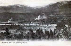
Collection No. 0039.0195: Wardner B.C. and Kootenay River, ca. 1908 - Image courtesy of the Columbia Basin Institute of Regional History The abundant minerals in the southern end of the East Kootenays and its proximity to Crowsnest, Elk Valley, and Flathead (over 500 million tonnes of coal have been produced since 1898) made...
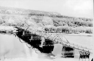
Wardner - The Riverboat Era
Kootenay River Bridge at Wardner Collection No. 2078.0020 - Image courtesy of the Columbia Basin Institute of Regional History Steamboats like the Gwendoline, North Star, and Ruth were the only means of travel to move materials and passengers before the railroad's arrival. Steamboating was the way of life in the East Kootenays...
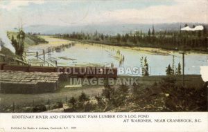
The City of the Crossing - Wardner B.C.
Kootenay River & Crow's Nest Pass Lumber Co. Collection No. 0017.0113 ca. 1909: Wardner B.C. - Image courtesy of the Columbia Basin Institute of Regional History Join us in our multi-part series on Wardner B.C. for a glimpse of pioneers and adventurers in the late 1890s. Trials and tribulations were part of founding the...
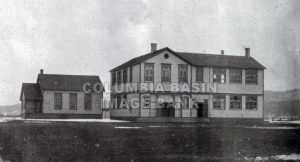
Back to School - Happy September Everyone!!
Cranbrook's First Public School ca.1900 Collection No. 0049.0158 It's back to school, everyone, and the Columbia Basin Institute of Regional History is sharpening its pencils over the next couple of weeks to celebrate the season. We will be honouring the arrival of the new school year with some throwbacks to a great tradition....
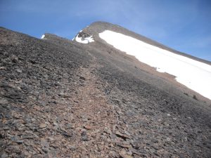
Best Guess – The naming of Mount Bill Nye
Mount Bill Nye - Photo courtesy of Kootenayskid In response to many queries, the Columbia Basin Institute of Regional History (CBIRH) went on a quest to discover the naming of Mount Bill Nye. We contacted the Provincial Toponymist who searched the Geo Names Archives and Resources Library for the name origins of Mount Bill...