Hiking the High Line
Bill Hurst
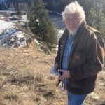
The collection of slides almost ended up in the trash. A member of the board of the Columbia Basin Institute of Regional History had heard about Bill’s collection of slides and had gone to Bill’s house in June 2013 to inquire about them. Unfortunately, Bill had just recently passed away and neighbours at the request of Bill’s next of kin were disposing of his possessions.
Bill was a quiet, solitary man who was a long serving volunteer at the Cranbrook Public Library and an avid gardener. He often attended neighbourhood block parties and was seen riding around town on his old bicycle. Most people didn’t know that Bill had climbed some of Canada’s most challenging peaks such as Mount Wood and Mount Hoge in the Yukon, Howser Spire in the Bugaboos, Mount Sir Sandford in the Big Bend ranges of the Selkirks, Tsar Mountain and Mount Robson in the Canadian Rockies, and the giant of the Coast Mountains, Mount Waddington.
he Institute was able to get in contact with Bill’s nephew in Switzerland and arrange for the collection to be digitally archived. The collection of over 1800 photographic slides in vivid Kodachrome chronicles (among other things) Bill Hurst’s mountaineering from the late 1950s to the 2000s. Bill’s photos will fascinate those with an interest in the history of climbing in the Rockies, those interested in how climbing gear has evolved and those interested in the rapid recession of glaciers.
Unfortunately, much of Bill’s story ended up being recycled or in the landfill. Research has revealed little of Bill Hurst’s past. He was born on November 8, 1924. Before coming to Cranbrook, he worked in Nelson in the 1960s for the water resource branch of the federal Department of Energy, Mines, and Resources doing hydrographic surveying in the Kootenays.
Oral history has it that Bill came to the Kootenays from the U.S. in the late 1950s. He was supposedly doing survey work for the North American Water and Power Alliance (N.A.W.A.P.A).
This project sought to divert the flows of rivers in Alaska, the Yukon, and northern BC to feed regions in the US like California, Nevada, and Texas. N.A.W.A.P.A. would channel and lift water to create a huge 500 mile long 10 mile wide reservoir in the Rocky Mountain trench. Under such a plan 100,000s of people would be displaced mainly in BC. Cranbrook, for example, would be flooded out and the remnants would be at the bottom of a vast reservoir.
It will surprise many people that in 2001, at the age of 74, to celebrate the 50th anniversary of his first ascent of Fisher Peak, Bill Hurst and Larry Farmer climbed 9,336 ft. Mount Fisher not by the usual route but by a tougher climb from the western ridge. A few years earlier, Bill close to 70 and Rick Collier successfully climbed Mount Battiste one of “The Three Giants of Nyahe-ya-nibi“ a 10,352 ft. mountain in Height of the Rockies Park and Stilleto Peak, a shorter mountain but a technically difficult climb. It was only the second recorded ascent for Battiste and Collier described the climbing as extremely challenging.

Robson Glacier August 1960

Mount Robson, Berg Glacier & Berg Lake

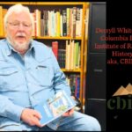
Bill Hurst Making Pancakes

Pangman Peak